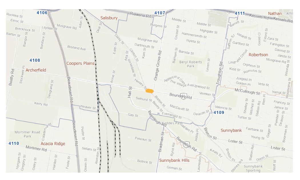
Boundary Road (Coopers Plains), rail level crossing, funding commitment
We are completing a business case to investigate options to reduce congestion and address safety concerns at Boundary Road, Coopers Plains rail level crossing...
We are completing a business case to investigate options to reduce congestion and address safety concerns at Boundary Road, Coopers Plains rail level crossing...
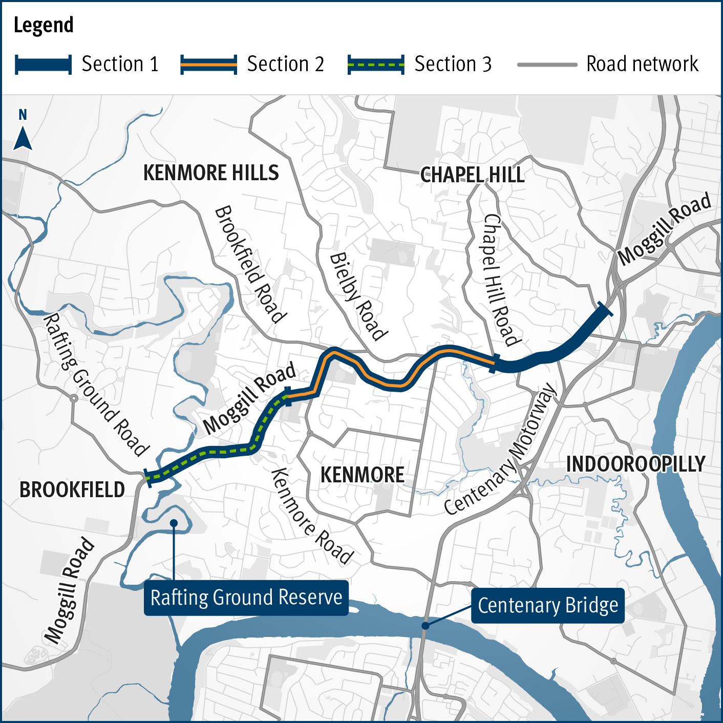
The department is undertaking active transport planning for the Moggill Sub-Arterial Road, Rafting Ground Reserve to Centenary Highway...
The Department of Transport and Main Roads (TMR) undertook community consultation on a proposed Warrego Highway – Mount Crosby Road interchange upgrade in mid-2020...
The Department of Transport and Main Roads (TMR) is undertaking planning to identify preferred options that address safety issues at the Warrego Highway and Haigslea-Amberley Road intersection...

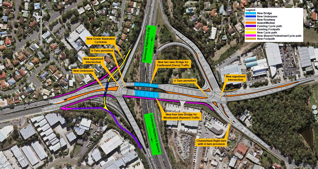
The Sumners Road Interchange Upgrade has become fully operational to the public...