
Mareeba – Dimbulah Road, Mareeba Heavy Vehicle Bypass, planning
This project will complete planning for the southern section of the Mareeba Bypass and review the alignment of the northern section...
This project will complete planning for the southern section of the Mareeba Bypass and review the alignment of the northern section...
Horton Parade Maroochydore Road Ocean Street and Beach Road intersection pedestrian safety improvements...

Planning will identify a preferred option for a future upgrade that improves efficiency, safety, and reliability for all road users...
The department has developed a preferred option for staged improvements to Maroochydore Road, Kunda Park to improve safety and relieve congestion...
The department is delivering safety improvements at the intersections of Bradman Avenue with Diura Street and Denna Street, Maroochydore...
The Department of Transport and Main Roads (TMR) is undertaking planning to identify priorities for the full length of Maroochydore–Noosa Road which runs from Ocean Street, Maroochydore to Emu...
The Department of Transport and Main Roads is undertaking detailed design for an upgrade of the Maryborough-Hervey Bay Road and Pialba-Burrum Heads Road intersection in Eli Waters...
Maryborough-Hervey Bay Road/Ibis Boulevard/Fairway Drive intersection upgrade...
The May Downs Road, pave and seal project is delivering $8 million in road improvements to boost connectivity between the western and eastern parts of the Isaac Regional Council area...
The department is undertaking active transport planning for the Moggill Sub-Arterial Road, Rafting Ground Reserve to Centenary Highway...
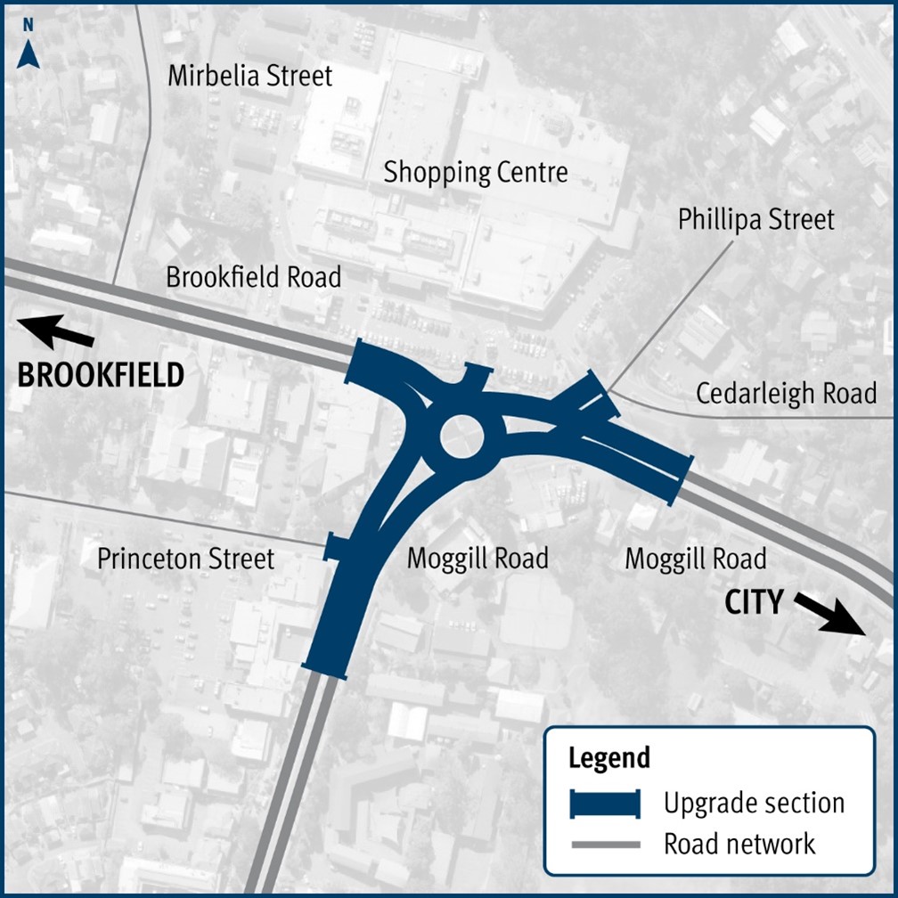
Planning is underway to upgrade the Kenmore roundabout...
A combined funding amount of $16 million has been allocated under the Australian Government's Road Safety Program and the State Road Network Upgrades investment program to progressively seal sections...
We are planning for a long-term solution to improve safety and accessibility for all users...
The intersection will be upgraded to minimise delays, congestion and queuing and improve safety along this busy section of the network...
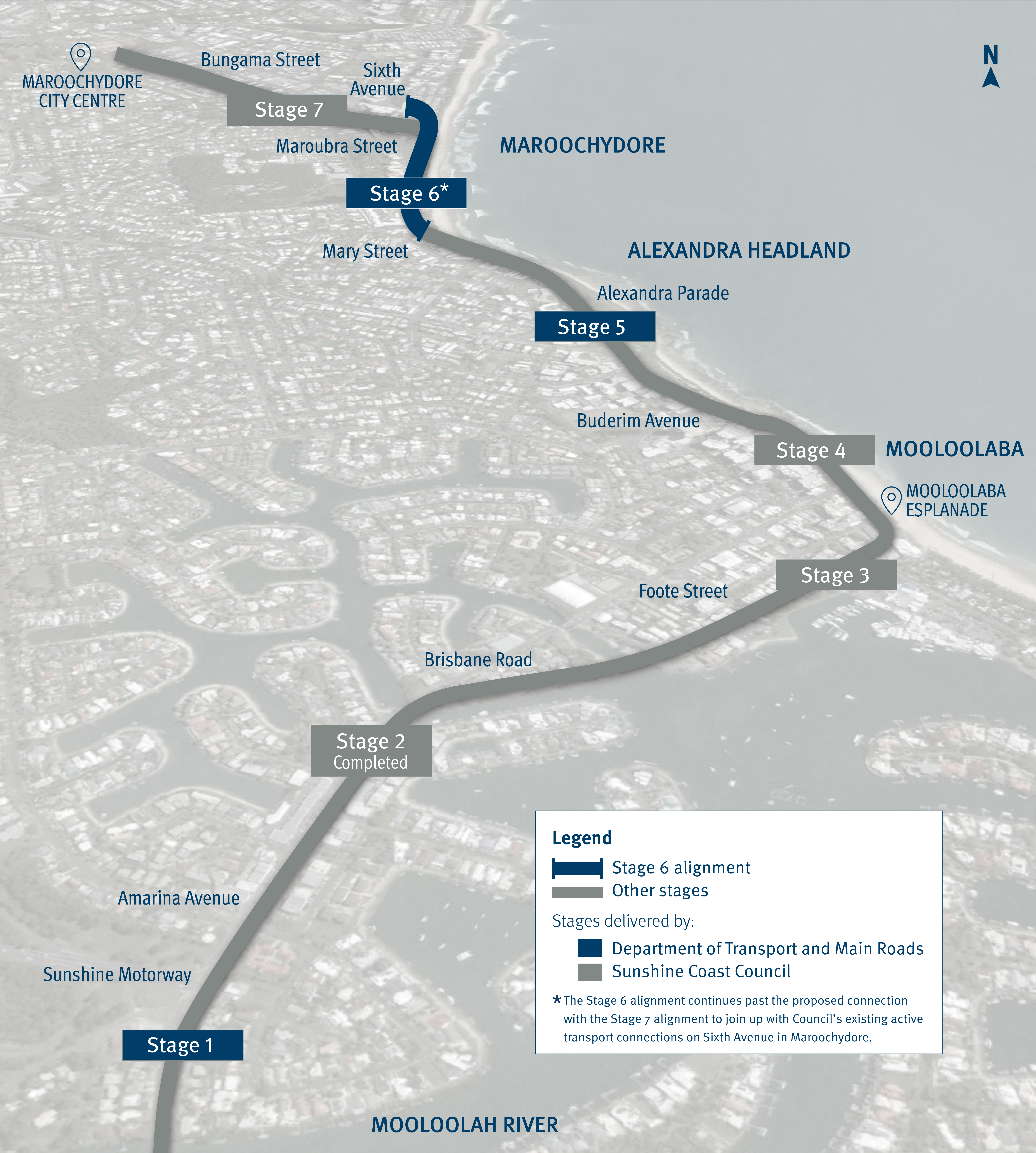
We are partnering with the Sunshine Coast Council to deliver the Mooloolaba to Maroochydore Cycleway...
We are undertaking planning for Mount Cotton Road, Redland Bay Road and the Redland Sub-Arterial Road, including the Double Jump Road, Ney Road and Taylor Road intersections...

We are undertaking a business case for the Beaudesert Road and Illaweena Street intersection upgrade project, Calamvale/Parkinson...
We are developing a masterplan to upgrade Beaudesert Road, between Nottingham Road and Compton Road, Calamvale to help to manage congestion along the corridor, and improve safety for all road users...
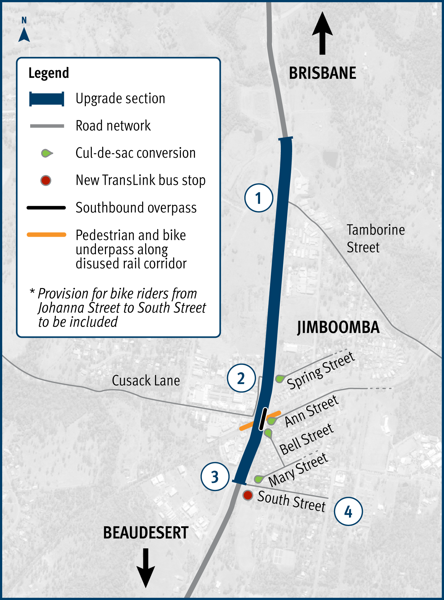
The Mount Lindesay Highway at Jimboomba will be upgraded to improve safety, reduce congestion and improve shared path connectivity...
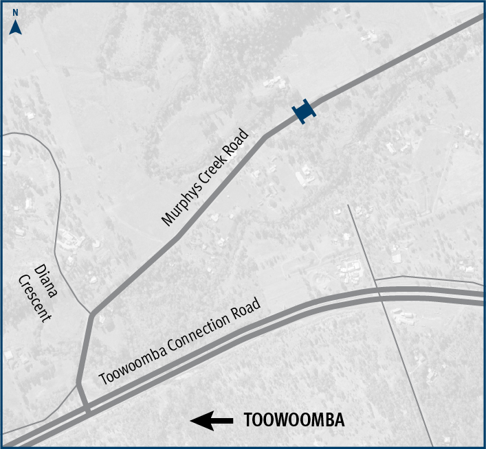
The Department of Transport and Main Roads is replacing Rocky Creek bridge on Murphys Creek Road at Postmans Ridge, with a two-lane concrete bridge...
Last updated: 6 February 2024