Queensland

307 Projects in Queensland showing 1-20

Filter projects

Filters

Status
Status
Programs
Programs
Type
Type
Reset
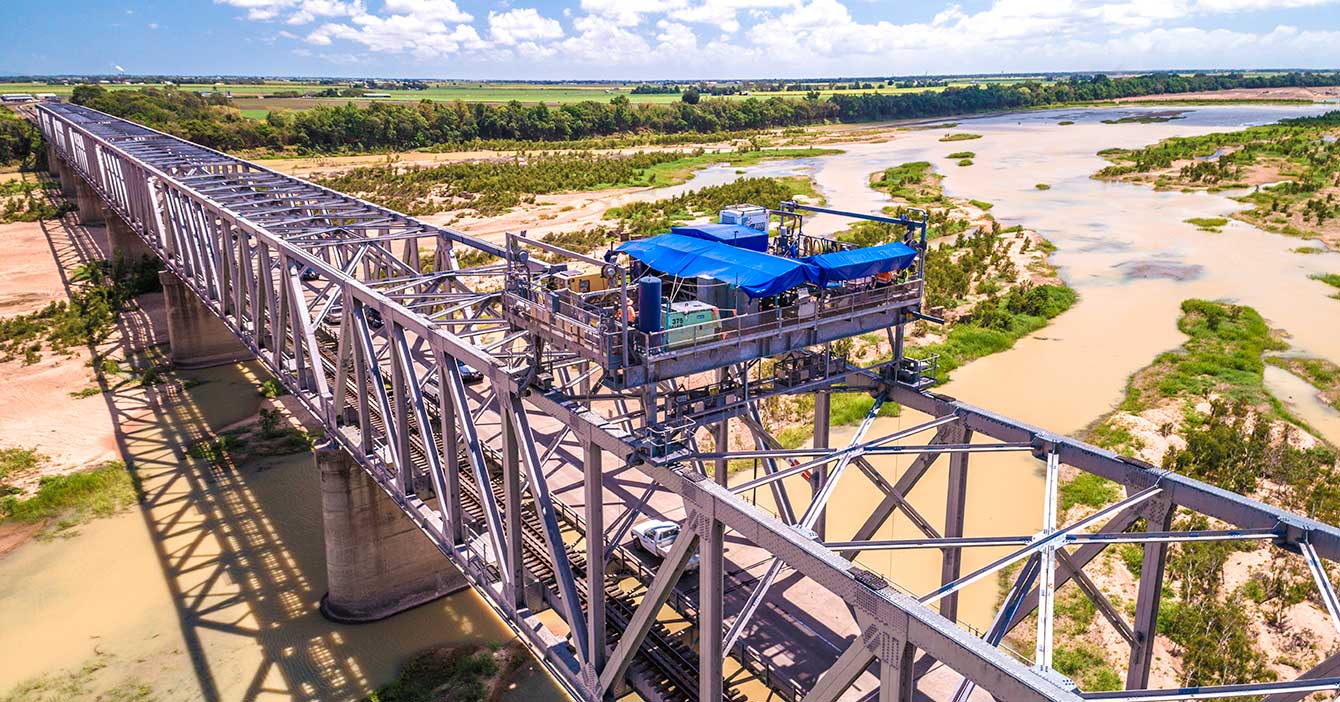
  1. Burdekin River Bridge, rehabilitation program

    Rehabilitation and maintenance program to preserve the structural integrity of the Burdekin River Bridge. The ongoing program will ensure a safe and durable crossing is maintained for the long-term...

    Burdekin River Bridge
  2. Access to Gladstone Port project

    The project will provide an alternate route for heavy vehicles accessing the Port of Gladstone to increase freight efficiency and improve safety for motorists by easing the impact of trucks travelling...

    No image supplied
  3. Altandi station park 'n' ride expansion business case

    We are planning to expand the park 'n' ride at Altandi station...

    No image supplied
  4. Bald Hills station park ‘n’ ride

    Planning is underway to expand the southern side of the park ‘n’ ride at Bald Hills station...

    No image supplied
  5. Banyo level crossing precinct upgrade

    We are investigating ways to make Banyo level crossing precinct safer...

    No image supplied
  6. Barcaldine-Aramac Road, rehabilitate and widen pavement

    About 20km of the Barcaldine-Aramac Road has been gradually widened to improve travelling conditions...

    No image supplied
  7. Barwon Highway (Talwood - Nindigully) Weengallon, pavement widening

    Pavement widening on the Barwon Highway has been completed to improve road safety, reduce ongoing maintenance...

    No image supplied
  8. Bayside and Redlands Transport and Mobility Study

    We've identified the need for a multi-modal transport study to investigate the transport challenges and mobility priorities relating to road, active transport and public transport modes. Our transport...

    No image supplied
  9. Beams Road (Carseldine and Fitzgibbon), upgrade rail level crossing

    The Beams Road overpass Level Crossing Upgrade project will reduce congestion and address safety concerns...

    No image supplied
  10. Beaudesert to Beenleigh corridor safety improvements

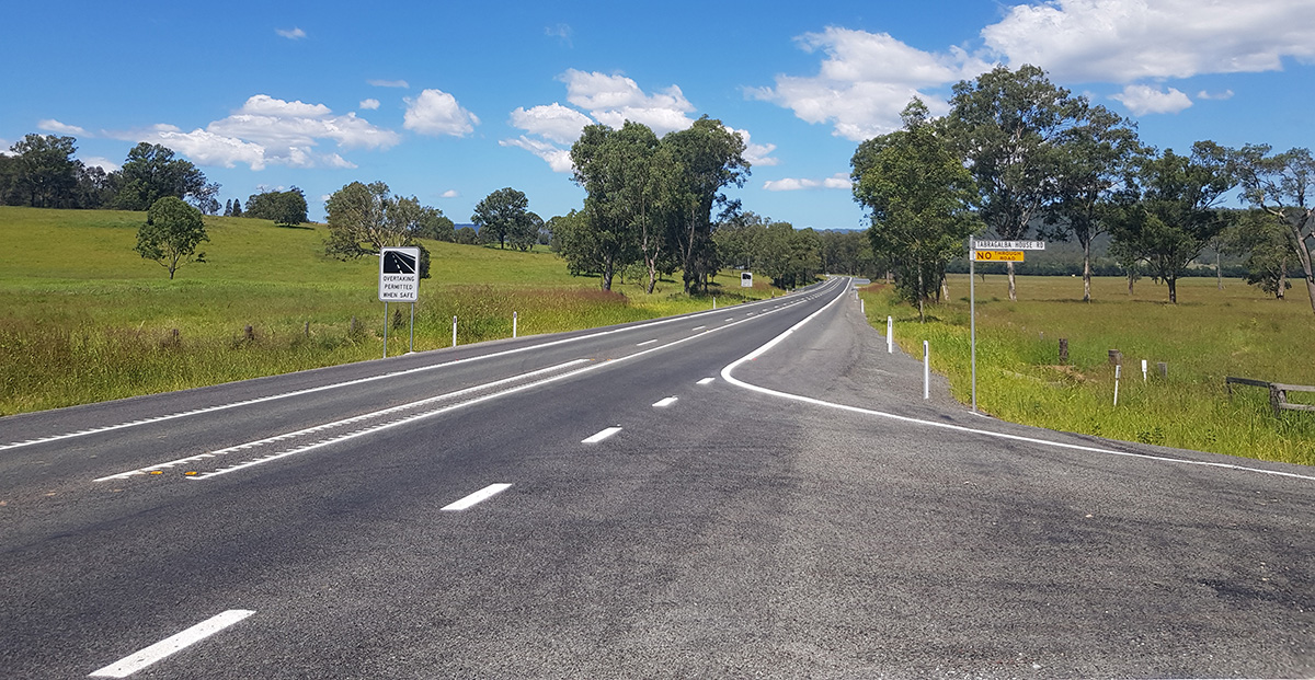
    The Department of Transport and Main Roads undertaking safety improvements on Beaudesert–Beenleigh Road...

    Photograph of the Beaudesert-Nerang Road and Tabragalba House Road intersection
  11. Beaudesert – Nerang Road and Yalkuri Drive, upgrade intersection

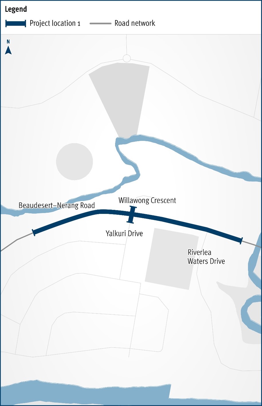
    The Department of Transport and Main Roads will be improving the safety and efficiency of the Beaudesert–Nerang Road, Yalkuri Drive and Willawong Crescent intersection at Nerang...

    The map shows the locality of the proposed Beaudesert-Nerang Road, Yalkuri Drive and Willawong Crescent intersection upgrade. Beaudesert is located to the west and Nerang to the east of the project location. A solid dark blue line indicates the project extent, which encompasses Yalkuri Drive south of the intersection and Willawong Crescent north of the intersection, as well as Beaudesert–Nerang Road, which is located west and east of the intersection. The local road network, Riverlea Waters Drive is also highlighted on the map.
  12. Beaudesert–Beenleigh Road, Milne Street to Tallagandra Road, duplicate to four lanes

    This project will see the road duplicated between Mount Warren Boulevard and Tallagandra Road...

    No image supplied
  13. Beenleigh Connection Road (Logan Street) and City Road, intersection upgrade

    Planning is underway for a potential future project to upgrade the intersection at Beenleigh Connection Road (Logan Street) and City Road, in Beenleigh...

    No image supplied
  14. Beenleigh train station upgrade

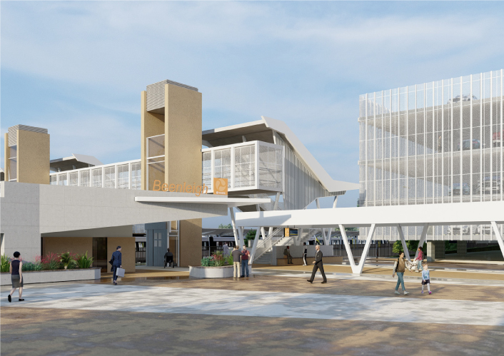
    We're relocating the Beenleigh train station to improve accessibility, safety, and overall customer experience as part of the Logan and Gold Coast Faster Rail project...

    Artist impression of Beenleigh Train station showing carpark, pedestrian overpass and lift and stair access.
  15. Beenleigh–Redland Bay Road, Logandale Boulevard to Mount Cotton Road upgrade, planning

    Planning will be undertaken for Beenleigh–Redland Bay Road between Logandale Boulevard and Mount Cotton Road...

    No image supplied
  16. Beerburrum to Nambour Rail Upgrade (Stage 1)

    The Beerburrum to Nambour Rail Upgrade (B2N) project covers about 40km of the North Coast Line...

     The North Coast Line meanders through the Glass House Mountains
  17. Bethania train station upgrade

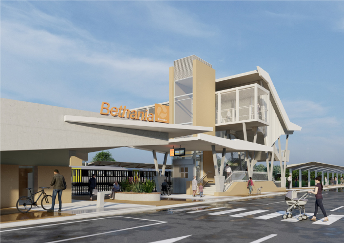
    We're upgrading the Bethania train station to improve accessibility, safety, and overall customer experience as part of the Logan and Gold Coast Faster Rail project...

    Artist impression of the Bethania train station from street view.
  18. Bicentennial Bikeway, Kurilpa Bridge to Victoria Bridge, design active transport upgrades

    The Bicentennial Bikeway – Kurilpa Bridge to Victoria Bridge upgrade provides an upgraded link for bicycle riders and pedestrians in Brisbane's Central Business District...

    No image supplied
  19. Booral Road and Boundary Road (Urangan), intersection upgrade

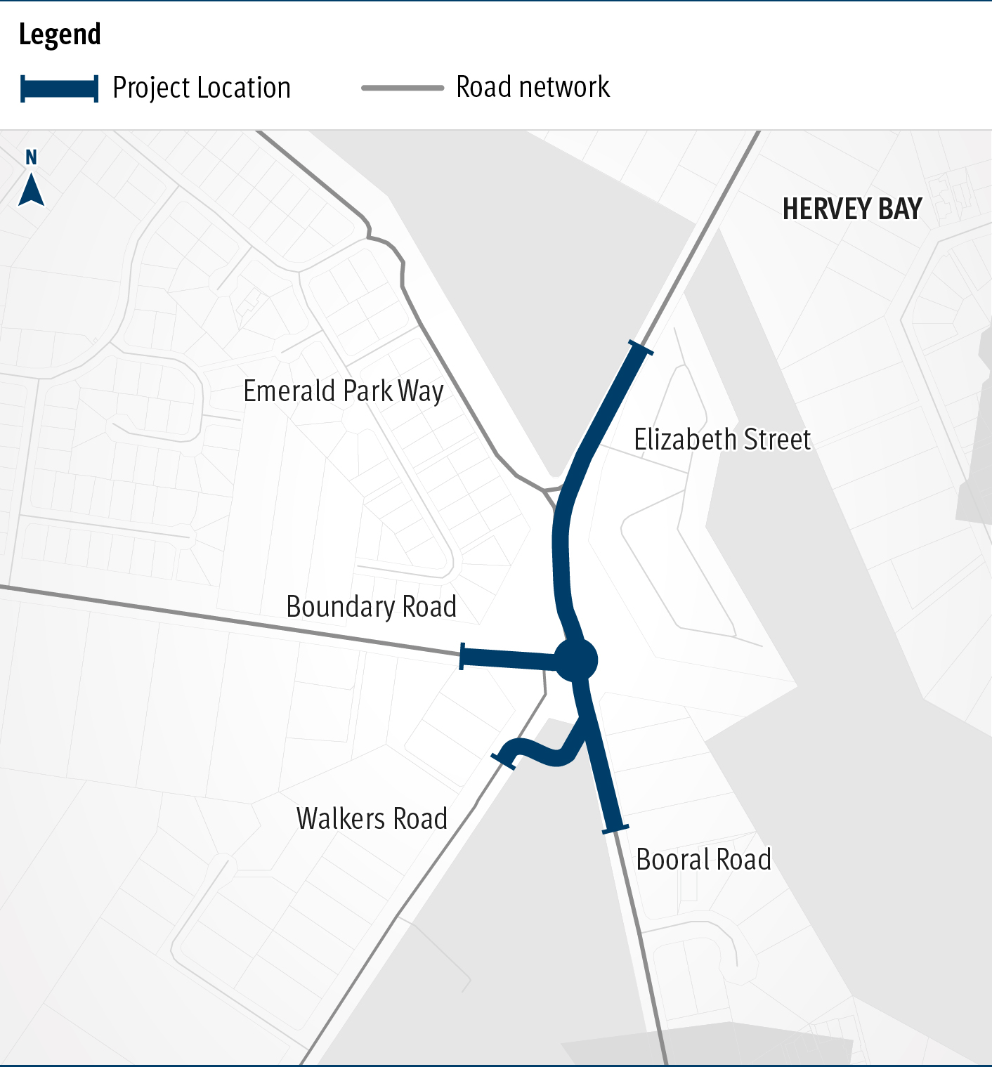
    Detailed design is underway for a proposed upgrade of the Booral Road and Boundary Road intersection...

    The map shows the locality of the proposed Booral Road and Boundary Road intersection upgrade. Hervey Bay is located north-east of the project location. A solid blue line indicates the project extent, which encompasses the Booral Road and Boundary Road intersection, and also extends along Booral Road to the north past the Emerald Park Way intersection and to the south along Booral Road past the proposed new Walkers Road intersection. Walkers Road has been realigned to access Booral Road to the south of the Booral Road and Boundary Road intersection. The local road network, including where Booral Road turns into Elizabeth Street, is also highlighted on the map.
  20. Booral Road, Bunya Creek floodway and Main Street intersection upgrade, planning

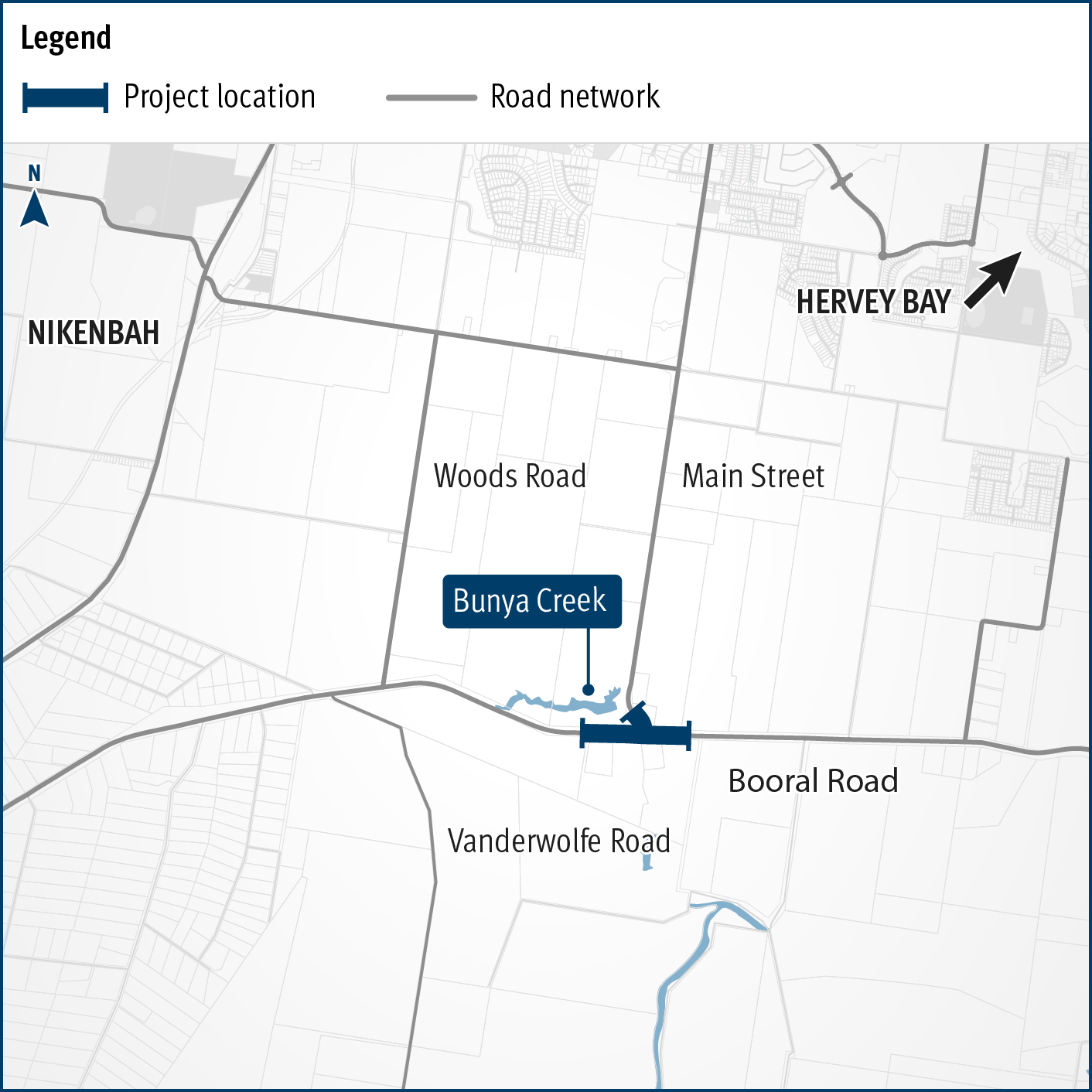
    Planning is underway to improve flood immunity and safety on a section of Booral Road at Bunya Creek, including the Main Street intersection...

    Alternative text: The map shows the locality of the proposed Booral Road, Bunya Creek floodway and Main Street intersection upgrade. Nikenbah is located to the north and Hervey Bay to the north-east. Bunya Creek is located just north west of the proposed project location. A solid dark blue line indicates the project extent, which encompasses the Booral Road and Main Street intersection as well as the Bunya Creek floodway along Booral Road, which is located just west of the intersection. The local road network, including Woods Road and Vanderwolfe Road are also highlighted on the map.
Previous Page (disabled)
  1. Page 1
  2. Page 2
  3. ...
  4. Page 16