
Mount Lindesay Highway (Brisbane - Beaudesert), Johanna Street to South Street (Jimboomba), duplication
The Mount Lindesay Highway at Jimboomba will be upgraded to improve safety, reduce congestion and improve shared path connectivity.
Procurement
The Mount Lindesay Highway at Jimboomba will be upgraded to improve safety, reduce congestion and improve shared path connectivity.
ProcurementThe Mount Lindesay Highway is being upgraded to improve safety and efficiency.
The Mount Lindesay Highway is one of Queensland's busiest highways. Currently there are between 25,000 and 45,000 vehicles per day using sections of the highway between Browns Plains and Jimboomba.
The 10-year strategic plan outlines the priority infrastructure projects for the Mount Lindesay Highway between 2018–2028.
| Upgrade project | Status | Funding |
| Mount Lindesay Highway (Brisbane-Beaudesert), Logan Motorway to Park Ridge Road, Combined Planning | ||
| Logan Motorway to Middle Road | Currently in planning 2023-26 | $1.5 million |
| Green Road/Coronation Road Interchange | Currently in planning 2023-26 | Combined |
| Mount Lindesay Highway (Brisbane-Beaudesert), North Mclean to Jimboomba, Combined Planning | ||
| Greenbank Road to Stockleigh Road | Currently in planning 2023-26 | $2 million |
| Chambers Flat Road to Greenbank Road | Currently in planning 2023-26 | $1 million |
| Stockleigh Road to Camp Cable Road | Currently in planning 2023-26 | $1.1 million |
| Johanna Street to South Street through Jimboomba | Under review | $57.4 million |
| South Street to Cedar Vale Road | Planning beyond 2026 | $1 million |
| Cedar Vale Road to Beaudesert | Planning beyond 2026 | Unfunded |
| Stoney Camp Road to Chambers Flat Road | Delivered 2023 |
$75 million |
| Jimboomba to Beaudesert safety improvements | Delivered 2021-2022 | $17.137 million |
| South Maclean safety improvements | Delivered 2020 |
$14 million |
| Camp Cable Road to Johanna Street, Jimboomba | Delivered 2020 |
$19.6 million |
| Rosia Road to Stoney Camp Road | Delivered 2020 |
$22.4 million |
| North Maclean safety improvements | Delivered 2019 | $20 million |
| Beaudesert Town Centre Bypass | Delivered 2017 | $27.5 million |
| Camp Cable Road intersection | Delivered 2016 | $7 million |
| Millstream Road intersection | Delivered 2015 | $2 million |
To improve safety and reduce congestion the Mount Lindesay Highway is being upgraded as funding becomes available. Find more information:

Upgrades to improve flood immunity at Jumper Creek, between Mackay and Proserpine are now complete.
The Bruce Highway upgrade project at Goorganga Plains and Myrtle Creek, near Proserpine, aims to plan and preserve the road corridor to enhance flood immunity and address access issues during wet weather events.
Construction has started at the Knobels Road and Nebia Coningsby Road intersection to improve safety and enhance visibility.
This project will provide Intelligent Transport System infrastructure at various locations along the Bruce Highway between Pine River and Cairns.
Safety upgrades have been completed to almost 20km of the Bruce Highway from Proserpine to Bowen, as part of the Bruce Highway Upgrade Program.

Eton Range fully opened to traffic on 1 October 2020. The existing range has been upgraded to 4 lanes, added a split carriageway for part of the range and reduced the grade to improve safety and efficiency.
Mackay Port Access will provide a direct link for freight movements from the Mackay Port to the Mackay Ring Road, and west to the Bowen Basin coal fields via the Walkerston Bypass and Peak Downs Highway.

An improved link has been delivered from the south to the northern suburbs reducing traffic through Mackay.
Planning is underway to identify potential future upgrades to Mackay – Bucasia Road to improve congestion, safety, and flooding impacts on this vital link to the Northern Beaches.
The Mount Lindesay Highway at Jimboomba will be upgraded to improve safety, reduce congestion and improve shared path connectivity.
An upgrade is being delivered to a 1.5km section of Proserpine-Shute Harbour Road in Cannonvale.
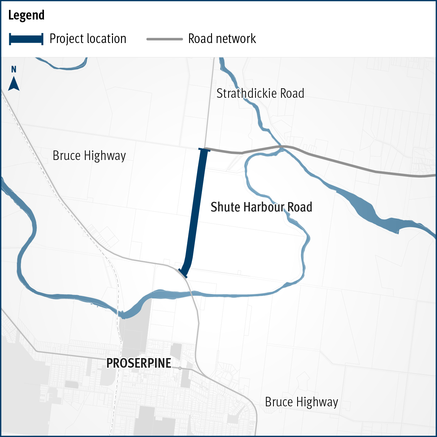
A flood immunity upgrade will be delivered to a 1.5km section of Proserpine – Shute Harbour Road at Hamilton Plains between the Bruce Highway turn-off and Strathdickie Road.

The Walkerston Bypass will deliver a new 2-lane rural highway to connect Peak Downs Highway west of Walkerston to the Mackay Ring Road near Paget.
Last updated: 6 November 2023