
Mapping the best routes for walking
Action 1.4, Action Plan for Walking 2022–2024
Department/Agency: Department of Transport and Main Roads
Status: Complete
Prepare Walking Network Plans in locations across Queensland to improve walkability on the state-controlled transport network.
Overview
The Department of Transport and Main Roads worked with local stakeholders to prepare walking network plans in 11 locations across Queensland. The plans identify the preferred routes for walking to and from important destinations such as town centres, hospitals and public transport.
Achievements
Department of Transport and Main Roads published the state's first guidance on walking network plans in 2021. The plans identify the preferred walking routes to and from a primary destination and are accompanied by priority works program to implement the plan.
To promote use of the guidance, Department of Transport and Main Roads funded walking network plans for the following primary destinations in south-east and northern Queensland:
- Broadbeach South Light Rail Station
- Ipswich Hospital
- Kippa-Ring Station
- Moorooka Station
- Springwood Station
- Sunshine Coast University Hospital
- Gordonvale (Gabay Gubudala pedestrian overpass)
- Mareeba Town Centre
- Northern Peninsula Area townships (Bamaga, Injinoo, New Mapoon, Seisia, Umagico)
- Townsville University Hospital
- Warrina Arcade precinct, Townsville.
These destinations were chosen because they are on state-controlled transport networks. The benefits of planning for walking go well beyond identifying opportunities for state assets to also include local government-controlled transport networks.
Between them, the plans generated 270km of planned primary walking routes and more than 350km of planned secondary walking routes connecting to the primary routes.
The plans include works programs that prioritise actions to make the network a reality as and when funding permits, such as building missing footpaths and convenient crossings, and providing shade.
Department of Transport and Main Roads worked with more than 150 representatives from state government departments, local governments, schools, community groups, shopping centres and health authorities.
- Mareeba Shire Council expanded its initial walking network plan around the town centre to include an audit of the walking network and infrastructure for the whole town.
- Northern Peninsula Area Regional Council organised pop-up consultation and interviews in four townships outside shops and other community facilities
- City of Gold Coast audited walking routes between Broadbeach South Light Rail Station and two local schools in partnership with the school principals
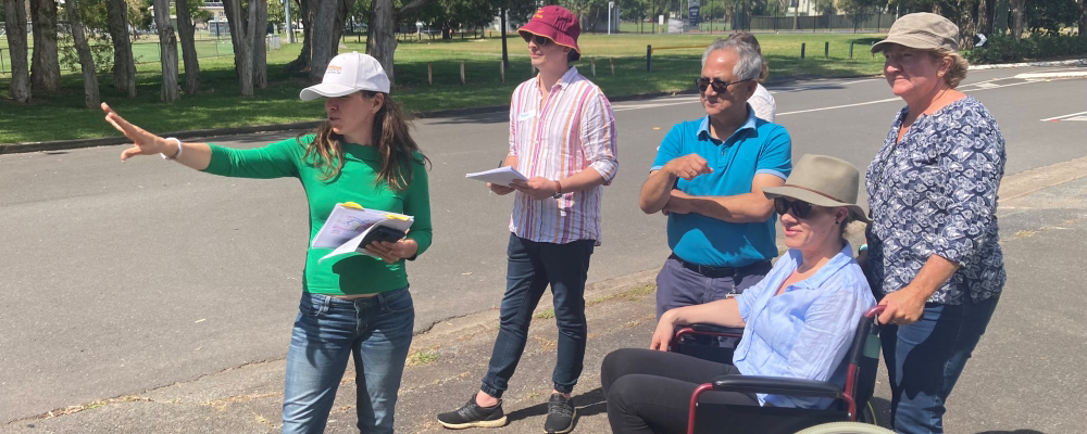
- The project engaged people using instrumented wheelchairs to gather inclusive mapping information at three of the locations. This helped participants to understand the barriers and improvements needed to assist people with mobility difficulties (see completed summary for Action 1.11).
Next steps
Department of Transport and Main Roads will promote its guidance on walking network plans for use in transport planning as part of major projects and focus on improving walking routes along, across, and to and from state-controlled assets.
Department of Transport and Main Roads will continue to work with project teams to implement the walking network plans and works programs as funding become available.
More information
- Last updated 13 November 2023