Natural Disaster Program

The department is working on more than 920 projects to restore roads across Queensland damaged by floods and bushfires. The department is also reconnecting communities and supporting regional economic recovery after disaster events damaged the state-controlled road network in 2020, 2021, 2022, 2023 and 2024.

Key features

  • Restoring access for communities and businesses. 
  • Restoring damaged roads and road surfaces.
  • Repairing damaged structures, including bridges and culverts.
  • Repairing damaged slopes and batters along roads.
  • Clearing silt and debris.

Benefits

  • Restores damaged infrastructure
  • Contributes to economy
  • Contributes to regional growth

About the program.

  • The Natural Disaster Program reconnects Queenslanders by repairing parts of the state-controlled road network damaged by natural disasters.
  • The department restores damaged sites to their pre-disaster level of service.
  • In the first 3 months after disaster events, the department undertakes emergency works such as clearing debris and filling potholes. This enables roads to be used safely while the department completes geotechnical and environmental investigations, surveys and detailed design for reconstruction works, where required.
  • Reconstruction works are completed within 2 financial years after the financial year in which the disaster event occurred.
  • Where possible, the program also supports the resilience of state roads to future disasters.

Current status

  • Damage assessments and repairs are underway across Queensland after significant disaster events in 2023–24. Tropical Cyclone Jasper caused multiple landslips on range roads around Cairns, a major debris clean-up is ongoing following severe storms across southern Queensland and flooding associated with Tropical Cyclone Kirrily damaged roads in western Queensland.
  • Repairs are ongoing after flooding across northern and central Queensland in early 2023.
  • A substantial recovery program is underway, particularly across southern Queensland, after major disaster events caused extensive damage in 2021–22. The program is repairing significant state road damage across 41 local government areas, including numerous major landslips, widespread pavement damage and shoulder scouring and widespread scouring around culverts and bridges.
  • Repairs are nearing completion in the Gold Coast hinterland following heavy rainfall and flooding in December 2020 and March 2021.
  • Reconstruction works are underway on the Cunningham Highway where bushfires caused significant slope damage at Cunninghams Gap in late 2019. Due to the severe damage and complex site, repairs are being undertaken over an extended period.
Funding

The recovery works are jointly funded by the Australian and Queensland Governments through the Disaster Recovery Funding Arrangements (DRFA).

Traffic info

These works may change traffic conditions that impact your travel. Visit QLDTraffic to plan your journey.

25 Projects in Natural Disaster Program

No image supplied

Bruce Highway (Ingham – Innisfail), Smiths Gap, construct southbound overtaking lane and fauna overpass

The department has built a southbound overtaking lane and fauna crossing at Smiths Gap on the Bruce Highway.

No image supplied

Bruce Highway (Innisfail - Cairns), Innisfail Bypass, plan and preserve corridor

The department is progressing a $9 million planning project to plan and protect a suitable road corridor for a future bypass of Innisfail, if required.

No image supplied

Bruce Highway (Innisfail – Cairns) and Munro street (Babinda) intersection upgrade

The department is progressing a project to upgrade the intersection of the Bruce Highway and Munro Street at Babinda.

John Davies Bridge, Bruce Highway, between Edmonton to Gordonvale

Bruce Highway, Cairns Southern Access Corridor (Stage 3), Edmonton to Gordonvale

A total transport solution has been delivered to provide long-term improvements to traffic flow and road safety through reducing congestion, highway travel time and improving road access.

No image supplied

Bruce Highway, Cairns Southern Access Corridor (Stage 5), Foster Road upgrade intersection

Planning for the Bruce Highway, Cairns Southern Access Corridor (Stage 5), Foster Road upgrade intersection project will assess and recommend options to upgrade this intersection.

No image supplied

Cairns Bruce Highway Upgrade master plan

The Cairns Bruce Highway Upgrade master plan was released in 2010. It was the result of a planning study that investigated long term, multi-modal transport planning options to address the impacts of urban growth, congestion and traffic accidents.

Cairns Southern Access Cycleway

Cairns Southern Access Cycleway, construct cycleway

The Department is reinvesting project savings to deliver a new off-road cycleway next to the Bruce Highway, consistent with the Cairns Bruce Highway Upgrade Masterplan. The project will deliver a safe off-road facility for bicycle riders of all abilities, including school children and the active transport community. The new cycleway also delivers a direct and continuous route with limited intersections to encourage bicycle riders to use the off-road facility.

No image supplied

Cairns Transit Network

Cairns Transit Network is the first busway planning project of its kind in regional Queensland. It will improve public transport in Cairns by giving buses priority, either in separate bus lanes or on dedicated bus-only lanes (busways) which will be separated from general traffic.

No image supplied

Cairns Transport Study, planning

By 2046, the Cairns local government area is expected to increase by approximately 59,000 residents. In addition to the substantial visitor numbers in the region, this significant residential growth will have an impact on the safety, efficiency and accessibility of the Cairns urban transport network.

Taking a holistic approach to the planning of this expected growth will ensure a sustainable, efficient and accessible transport network in the region. 

Cairns Western Arterial Road, Redlynch Connector Road to Captain Cook Highway, duplication

The department is undertaking a $300 million project to duplicate the Cairns Western Arterial Road between Redlynch Connector Road and Captain Cook Highway.

No image supplied

Cairns to Northern Tablelands Access Strategy

The department has completed a comprehensive planning study into the 4 transport corridors linking Cairns to the Northern Tablelands.

No image supplied

Cape York Region Package Stage 2

The Cape York Region Package Stage 2 is a program of works to deliver infrastructure upgrades on the Cape York Peninsula between 2019-2020 and 2023-2024.

No image supplied

Captain Cook Highway, Cairns CBD to Smithfield, Upgrade

Master planning is progressing on the Captain Cook Highway between Cairns CBD and Smithfield.

Aerial image of Cunningham Highway at Cunninghams Gap

Cunningham Highway (Ipswich – Warwick), 2020 Disaster Recovery Funding Arrangements reconstruction works

The department is committed to restoring and repairing the damaged section of the Cunningham Highway at Cunninghams Gap. This 2km stretch, leading up to the Allan Cunningham monument, suffered significant road damage during the bushfires in 2019.

Flood resilience works

The department is improving the flood immunity and resilience of the state-controlled road network at 27 priority sites.

Aerial view of Gold Coast-Springbrook Road major slip site

Gold Coast-Springbrook Road, Disaster Recovery Funding Arrangements reconstruction works

Gold Coast-Springbrook sustained a significant number of landslips, rock falls and tree falls over a 10-kilometre section during extreme rainfall and flooding events from 22 February to 20 May 2022.

No image supplied

Gulf Developmental Road (Croydon - Mount Garnet), strengthen and widen pavement

The Gulf Developmental Road is the principal freight and tourism route connecting Carpentaria Shire via the Kennedy Highway, with the Bruce Highway coastal link. The road is sealed, however there are 19 sections spread over 47kms that are only single lane.

Thumbnail image of bride and inspection unit

Kennedy Highway (Cairns - Mareeba), Barron River bridge upgrade, planning

The Barron River bridge planning project aims to explore long-term, sustainable solutions for the bridge located near Kuranda.

Kennedy Highway (Cairns - Mareeba), Kuranda Range, Intelligent Transport System

Intelligent Transport Systems (ITS) treatments on Kuranda Range Road have been installed. The Intelligent Transport System treatments will make it quicker and easier to manage incidents and reduce the risk of crashes.

Aerial photograph of a major landslip on Lamington National Park Road

Lamington National Park Road, Disaster Recovery Funding Arrangements reconstruction works

The department is working on multiple locations along Lamington National Park Road which require pavement rehabilitation and permanent reconstruction work following record rainfall across south east Queensland since December 2020.

Vehicles travelling along Mareeba–Dimbulah Road locally known as Byrnes Street

Mareeba – Dimbulah Road, Mareeba Heavy Vehicle Bypass, planning

This project will progress planning for the southern section of the Mareeba Bypass and review the alignment of the northern section.

An unpaved road between a mountain and bollards

South Coast 2020–21 flood reconstruction works

Reconstruction works are underway across the South East Region, including the Gold Coast and Scenic Rim, to repair storm damaged roads.

Landslip on Gold Coast - Springbrook Road

Southern Queensland 2022 flood reconstruction works

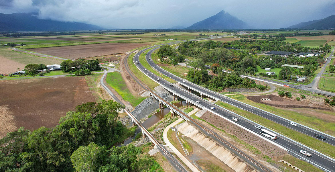
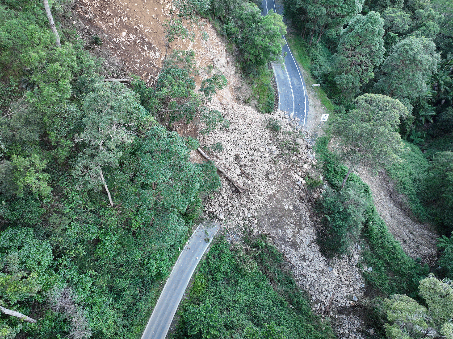
Repairs are underway across southern Queensland after extensive and severe damage to the state-controlled road network was caused by multiple heavy rainfall and flooding events in 2022.

No image supplied

Yorkeys Knob—boat ramp

We are constructing a new recreational boat launching facility at Yorkeys Knob.