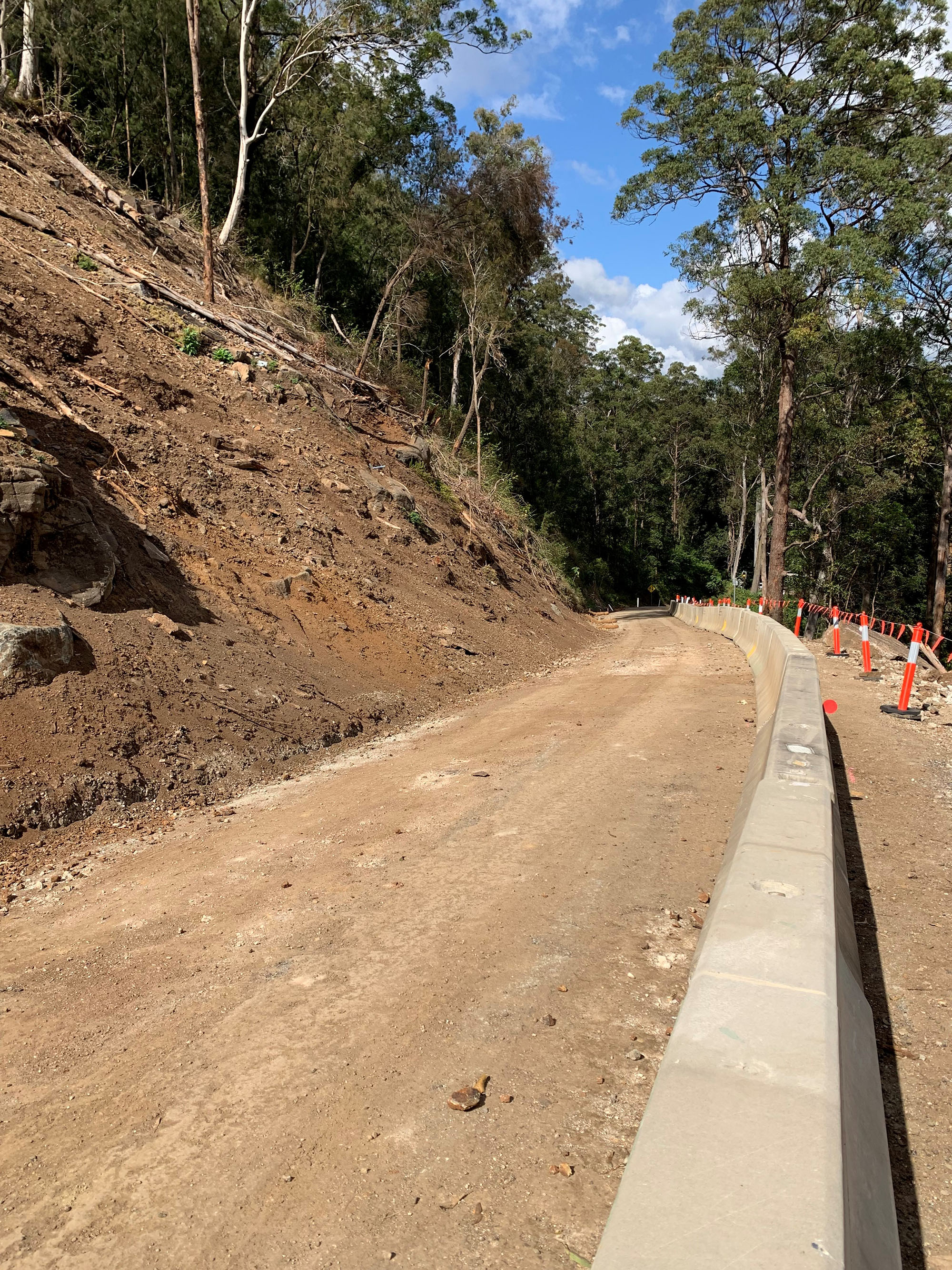
Natural Disaster Program

The department is working on more than 920 projects to restore roads across Queensland damaged by floods and bushfires. The department is also reconnecting communities and supporting regional economic recovery after disaster events damaged the state-controlled road network in 2020, 2021, 2022, 2023 and 2024.

Key features

  • Restoring access for communities and businesses. 
  • Restoring damaged roads and road surfaces.
  • Repairing damaged structures, including bridges and culverts.
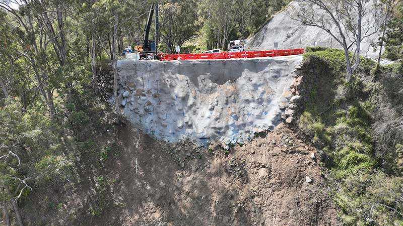
  • Repairing damaged slopes and batters along roads.
  • Clearing silt and debris.

Benefits

  • Restores damaged infrastructure
  • Contributes to economy
  • Contributes to regional growth

About the program.

  • The Natural Disaster Program reconnects Queenslanders by repairing parts of the state-controlled road network damaged by natural disasters.
  • The department restores damaged sites to their pre-disaster level of service.
  • In the first 3 months after disaster events, the department undertakes emergency works such as clearing debris and filling potholes. This enables roads to be used safely while the department completes geotechnical and environmental investigations, surveys and detailed design for reconstruction works, where required.
  • Reconstruction works are completed within 2 financial years after the financial year in which the disaster event occurred.
  • Where possible, the program also supports the resilience of state roads to future disasters.

Current status

  • Damage assessments and repairs are underway across Queensland after significant disaster events in 2023–24. Tropical Cyclone Jasper caused multiple landslips on range roads around Cairns, a major debris clean-up is ongoing following severe storms across southern Queensland and flooding associated with Tropical Cyclone Kirrily damaged roads in western Queensland.
  • Repairs are ongoing after flooding across northern and central Queensland in early 2023.
  • A substantial recovery program is underway, particularly across southern Queensland, after major disaster events caused extensive damage in 2021–22. The program is repairing significant state road damage across 41 local government areas, including numerous major landslips, widespread pavement damage and shoulder scouring and widespread scouring around culverts and bridges.
  • Repairs are nearing completion in the Gold Coast hinterland following heavy rainfall and flooding in December 2020 and March 2021.
  • Reconstruction works are underway on the Cunningham Highway where bushfires caused significant slope damage at Cunninghams Gap in late 2019. Due to the severe damage and complex site, repairs are being undertaken over an extended period.
Funding

The recovery works are jointly funded by the Australian and Queensland Governments through the Disaster Recovery Funding Arrangements (DRFA).

Traffic info

These works may change traffic conditions that impact your travel. Visit QLDTraffic to plan your journey.

25 Projects in Natural Disaster Program

The map shows the locality of the proposed Booral Road and Boundary Road intersection upgrade. Hervey Bay is located north-east of the project location. A solid blue line indicates the project extent, which encompasses the Booral Road and Boundary Road intersection, and also extends along Booral Road to the north past the Emerald Park Way intersection and to the south along Booral Road past the proposed new Walkers Road intersection. Walkers Road has been realigned to access Booral Road to the south of the Booral Road and Boundary Road intersection. The local road network, including where Booral Road turns into Elizabeth Street, is also highlighted on the map.

Booral Road and Boundary Road (Urangan), intersection upgrade

Detailed design is underway for a proposed upgrade of the Booral Road and Boundary Road intersection at Urangan.

Alternative text: The map shows the locality of the proposed Booral Road, Bunya Creek floodway and Main Street intersection upgrade. Nikenbah is located to the north and Hervey Bay to the north-east. Bunya Creek is located just north west of the proposed project location. A solid dark blue line indicates the project extent, which encompasses the Booral Road and Main Street intersection as well as the Bunya Creek floodway along Booral Road, which is located just west of the intersection. The local road network, including Woods Road and Vanderwolfe Road are also highlighted on the map.

Booral Road, Bunya Creek floodway and Main Street intersection upgrade, planning

Planning is underway to improve flood immunity and safety on a section of Booral Road at Bunya Creek, including the Main Street intersection.

No image supplied

Brisbane to Sunshine Coast Rail Corridor Strategy

We are developing a rail corridor vision and a staged program of rail priorities to 2051 on the North Coast Line between Brisbane and Gympie North.

Looking north towards an 8 span, 260 metre long concrete bridge structure over Deep Creek with construction crews on the bridge completing the final layer of pavement in preparation for linemarking. There is a bio-retention basin (like a sediment pond) in the foreground.

Bruce Highway (Cooroy to Curra) Section D

The $1.162 billion Section D: Woondum to Curra project is a new 26km, 4-lane divided highway between the existing Bruce Highway interchange at Woondum, south of Gympie and Curra.

No image supplied

Bruce Highway (Gympie – Maryborough), Tiaro Bypass, construct four lane bypass

Planning is complete and the detailed design stage has commenced for a new four-lane section of the Bruce Highway to the east of Tiaro. The project will increase the flood immunity, safety and efficiency of the Bruce Highway and future-proof the road to cater for growing traffic volumes. It will also remove a significant number of heavy vehicles from the Tiaro township, improving safety and liveability for residents.

No image supplied

Bruce Highway—Cooroy to Curra

This project involves a 62km realignment and upgrade of the Bruce Highway to 4 lanes between Cooroy and Curra and is among Queensland's highest priority road projects.

No image supplied

Bundaberg Integrated Transport Strategy, planning

The Bundaberg Integrated Transport Strategy is being jointly developed by the Department of Transport and Main Roads and Bundaberg Regional Council to develop an overarching framework that aims to integrate plans and policies, current and future, relating to the movement of people and services.

No image supplied

Bundaberg Port Rail Link Study

In October 2007 Transport and Main Roads (then Queensland Transport) engaged GHD to undertake a study to identify a rail corridor (for freight traffic) to connect the Port of Bundaberg to the existing rail network via the North Coast line. The study report determined that protection of the corridor within the local government planning scheme was not warranted at the time, and the project was closed.

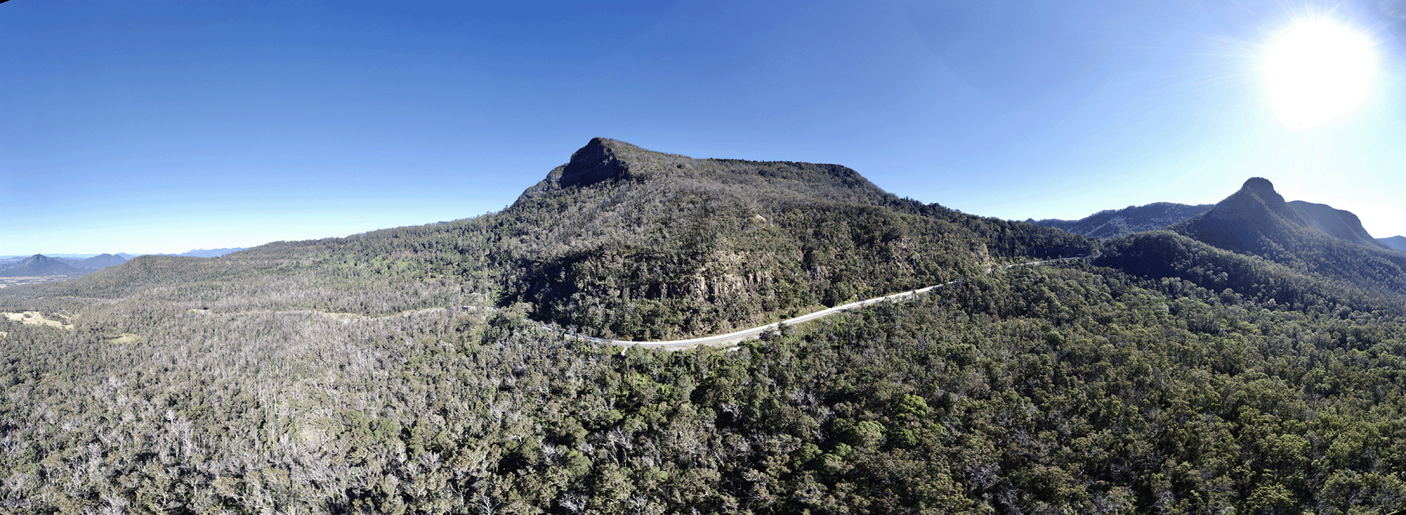
Aerial image of Cunningham Highway at Cunninghams Gap

Cunningham Highway (Ipswich – Warwick), 2020 Disaster Recovery Funding Arrangements reconstruction works

The department is committed to restoring and repairing the damaged section of the Cunningham Highway at Cunninghams Gap. This 2km stretch, leading up to the Allan Cunningham monument, suffered significant road damage during the bushfires in 2019.

No image supplied

D'Aguilar Highway (Yarraman – Kingaroy), various locations, improve safety

Construction and design works are underway for upgrades at various locations as part of a program of works to improve the D'Aguilar Highway between Yarraman and Kingaroy.

Flood resilience works

The department is improving the flood immunity and resilience of the state-controlled road network at 27 priority sites.

Aerial view of Gold Coast-Springbrook Road major slip site

Gold Coast-Springbrook Road, Disaster Recovery Funding Arrangements reconstruction works

Gold Coast-Springbrook sustained a significant number of landslips, rock falls and tree falls over a 10-kilometre section during extreme rainfall and flooding events from 22 February to 20 May 2022.

No image supplied

Gympie – Brooloo Road, design active transport crossings

Detailed design is underway for active transport bridges and pathways to connect Southside to Gympie's CBD and surrounds.

No image supplied

Isis Highway (Bundaberg – Childers), various locations, improve safety

The department will improve safety on a 40km stretch of the Isis Highway from Airport Drive to the Bruce Highway.

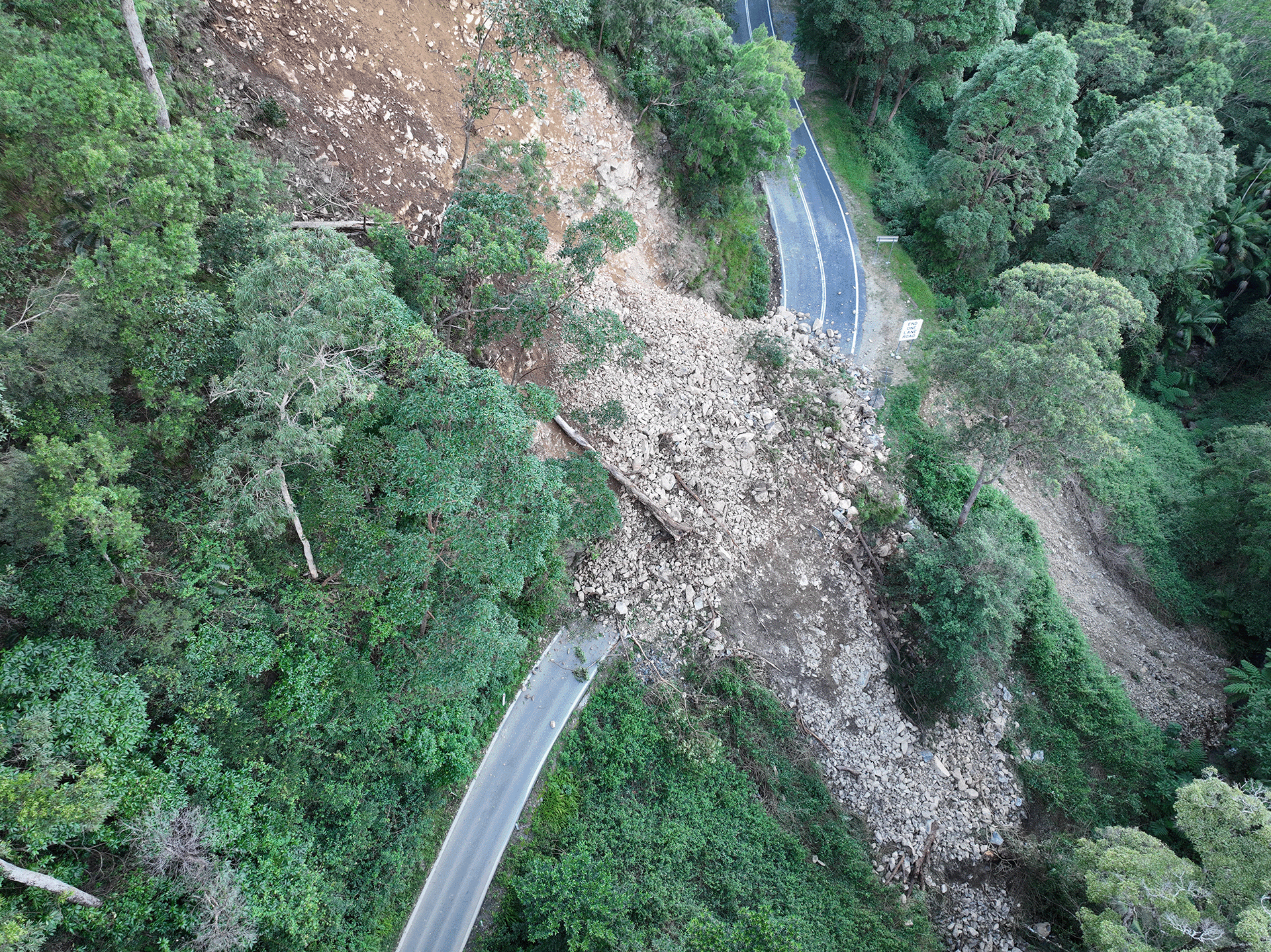
Aerial photograph of a major landslip on Lamington National Park Road

Lamington National Park Road, Disaster Recovery Funding Arrangements reconstruction works

The department is working on multiple locations along Lamington National Park Road which require pavement rehabilitation and permanent reconstruction work following record rainfall across south east Queensland since December 2020.

No image supplied

Maryborough - Hervey Bay Road and Pialba - Burrum Heads Road, upgrade intersection

The upgrade of the Maryborough - Hervey Bay Road and Pialba - Burrum Heads Road intersection in Eli Waters will improve traffic movement and the safety of motorists, pedestrians and bicycle riders.

No image supplied

Maryborough-Hervey Bay Road, Ibis Boulevard and Fairway Drive, intersection upgrade, business case

Planning is underway for an upgrade of the Maryborough-Hervey Bay Road, Ibis Boulevard and Fairway Drive intersection.

No image supplied

Monto – Mount Perry Road progressive sealing

The department is progressively upgrading and sealing the gravel sections of Monto - Mount Perry Road to improve road user safety and comfort, and reduce future maintenance requirements. 

Pialba–Burrum Heads Road, O’Regan Creek, upgrade existing floodway project location map

Pialba–Burrum Heads Road, O’Regan Creek, upgrade existing floodway

This upgrade will improve flood resilience for Hervey Bay and surrounding communities and involves pavement realignment, widening and culvert upgrades.

An unpaved road between a mountain and bollards

South Coast 2020–21 flood reconstruction works

Reconstruction works are underway across the South East Region, including the Gold Coast and Scenic Rim, to repair storm damaged roads.

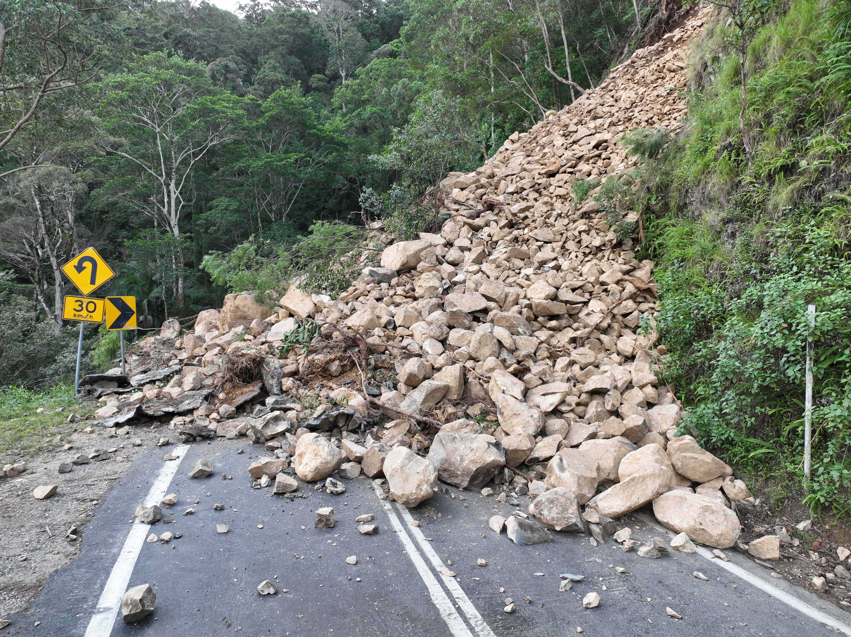
Landslip on Gold Coast - Springbrook Road

Southern Queensland 2022 flood reconstruction works

Repairs are underway across southern Queensland after extensive and severe damage to the state-controlled road network was caused by multiple heavy rainfall and flooding events in 2022.

No image supplied

Tin Can Bay Road and Bayside Road, construct roundabout

Construction will commence this year on a new roundabout at the intersection of Tin Can Bay Road and Bayside Road, at Tin Can Bay.

Artist's impression of the Torbanlea train manufacturing facility

Torbanlea manufacturing facility

A new facility is being constructed in the Maryborough region, to manufacture the Queensland Train Manufacturing Program fleet. 

No image supplied

Torbanlea – Pialba Road, various locations, upgrade intersections and floodways

Work is underway on flood immunity and intersection upgrades along sections of Torbanlea – Pialba Road between Beelbi Creek and Takura.