
Caboolture–Bribie Island Road, Bribie Island bridge, planning
The department is finalising a business case for the construction of a new bridge to Bribie Island.
Planning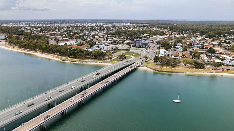
The department is finalising a business case for the construction of a new bridge to Bribie Island.
Planning
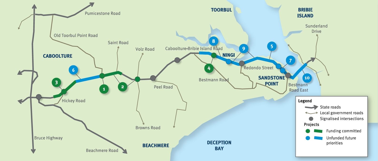
The future duplication of Caboolture-Bribie Island Road between King Johns Creek and Hickey Road will ease congestion and improve safety.
Detailed design
The department is undertaking detailed design for the duplication of Caboolture-Bribie Island Road between Old Toorbul Point Road and Saint Road, including signalisation of the Volz Road intersection.
Detailed designThe department is planning sequential upgrades to improve safety, ease congestion and improve traffic flow and connectivity on critical sections of Caboolture-Bribie Island Road.
The road will be upgraded to 4 lanes, with a median-divided cross section for its entire length.
The department has developed the Bribie Island Road Upgrade Strategy which identifies a program of works to deliver upgrade projects sequentially on Caboolture-Bribie Island Road.
As projects are progressed, consultation with key stakeholders and the community will be undertaken.
Upgrading Caboolture-Bribie Island Road will help ease congestion, improve safety and flood immunity in critical areas.
Construction of the Old Toorbul Point Road intersection upgrade was completed in early October 2021. The upgrade of Regina Avenue intersection to install new traffic signals was completed in March 2023. Detailed design is underway for the duplication of Caboolture-Bribie Island Road between Old Toorbul Point Road and Saint Road, including signalisation of the Volz Road intersection. Planning for the future duplication of Caboolture-Bribie Island Road between King Johns Creek and Hickey Road is underway. A business case is underway for a new Bribie Island Bridge.
The Australian Government and Queensland Government are funding 4 projects under this program.
The Australian Government has committed $38.91 million and the Queensland Government has committed $49.68 million to progress priority upgrades. Investment IDs 1158882, 1779573, 1862714 and 489249.
The Australian Government’s independent Strategic Review of its Infrastructure Investment Program allocated an additional $8,915,000 by the Australian Government. Project cost and funding contributions under this program are subject to further consideration and negotiation.
Funding figures updated December 2023 to reflect increased Australian Government contributions.

The Beerburrum to Nambour Rail Upgrade will provide additional track capacity and reliability, creating travel time savings and increased passenger and freight services to the growing Sunshine Coast region.

Detailed design is underway for a proposed upgrade of the Booral Road and Boundary Road intersection at Urangan.

A preferred option has been identified to reduce congestion and address safety concerns at Boundary Road, Coopers Plains rail level crossing.

Planning is complete and the detailed design stage has commenced for a new four-lane section of the Bruce Highway to the east of Tiaro. The project will increase the flood immunity, safety and efficiency of the Bruce Highway and future-proof the road to cater for growing traffic volumes. It will also remove a significant number of heavy vehicles from the Tiaro township, improving safety and liveability for residents.
The future duplication of Caboolture-Bribie Island Road between King Johns Creek and Hickey Road will ease congestion and improve safety.
The department is undertaking detailed design for the duplication of Caboolture-Bribie Island Road between Old Toorbul Point Road and Saint Road, including signalisation of the Volz Road intersection.
The department is finalising a business case for the construction of a new bridge to Bribie Island.
The department is undertaking a $300 million project to duplicate the Cairns Western Arterial Road between Redlynch Connector Road and Captain Cook Highway.
The Cannon Hill Shopping Centre bus facility is proposed to be upgraded.
The department is working with Ipswich City Council to upgrade the Centenary Motorway exit ramp (Exit 32), and the Main Street and Springfield Greenbank Arterial Road intersection, to manage congestion and improve safety at the exit ramp.
Coomera Connector (Stage 1) is around 16km long and will be delivered in 3 construction packages. Stage 1 Central, which is currently in the design phase, is the 8km section from Helensvale Road to Smith Street Motorway.
Design phase is underway for the Coomera Connector Stage 1 South package from Smith Street Motorway to Nerang-Broadbeach Road.
The Buaraba Creek timber bridge replacement project will improve safety and network reliability by replacing the existing narrow, timber bridge (Neithe Bridge) with a new wider, two-lane, concrete structure in the same location.
The project involves investigating safety improvements to provide a better driving experience for all road users and reduce the risk of fatal and serious injury crashes.
This project involves investigating safety improvements to provide a better driving experience for all road users and reduce the risk of fatal and serious injury crashes.
On-road bicycle lanes are being constructed to improve safety at Marcoola and Mudjimba.

Detailed design has started for future expansion of parking facilities at Gaythorne station.
The department will deliver a new signalised intersection on Glass House Mountains Road, known locally as Steve Irwin Way, at Caloundra Street, Landsborough.
Detailed design is underway for active transport bridges and pathways to connect Southside to Gympie's CBD and surrounds.
The upgrade of the Maryborough - Hervey Bay Road and Pialba - Burrum Heads Road intersection in Eli Waters will improve traffic movement and the safety of motorists, pedestrians and bicycle riders.

The department is partnering with Sunshine Coast Council to deliver the Mooloolaba to Maroochydore cycleway which will provide a bicycle path connecting Mooloolaba to Maroochydore.

An ultimate project footprint has been identified for the Caloundra Transport Corridor Upgrade, including the Nicklin Way, Third Avenue extension.

Work is being undertaken on the Pacific Motorway, Eight Mile Plains to Daisy Hill Upgrade, to improve 8kms of the Pacific Motorway (M1) between the Gateway Motorway and Watland Street.

This upgrade will improve flood resilience for Hervey Bay and surrounding communities and involves pavement realignment, widening and culvert upgrades.
An upgrade is being delivered to a 1.5km section of Proserpine-Shute Harbour Road in Cannonvale.
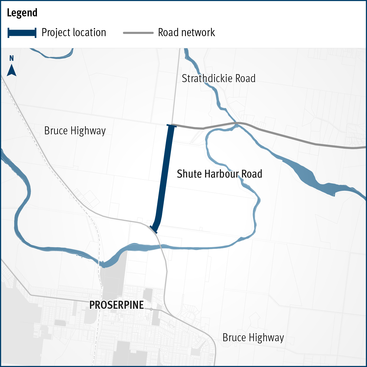
A flood immunity upgrade will be delivered to a 1.5km section of Proserpine – Shute Harbour Road at Hamilton Plains between the Bruce Highway turn-off and Strathdickie Road.
The Sunshine Motorway, Mooloolah River Interchange Upgrade will address well-known safety and congestion issues that are forecast to increase due to regional population growth and development, while also delivering improved north-south connectivity on the Sunshine Coast.
More than $16 million is committed to improve flood resilience across Gulf communities after monsoonal flooding produced widespread impacts across the northern 2-thirds of Queensland in early 2023.
Detailed design commenced in October 2023 and is expected to be completed in June 2024.

The department has completed planning to identify a preferred option for the upgrade of Warrego Highway – Mount Crosby Road interchange.
Last updated: 11 June 2024