
Booral Road and Boundary Road (Urangan), intersection upgrade
Detailed design is underway for a proposed upgrade of the Booral Road and Boundary Road intersection at Urangan.
Accelerated funding has been allocated through the following Road Stimulus Packages to increase investment in roads and transport infrastructure as part of The Queensland Economic Recovery Strategy.
Together with the Australian Government, we are improving Queensland's inland freight corridors by investing $185 million across 22 projects. The Roads of Strategic Importance early works package projects are jointly funded by the Australian and Queensland Governments.
These projects will help the freight and logistic industry move essential goods throughout Queensland more efficiently while protecting the safety of all road users.
Project works include:
View details of all jointly-funded Roads of Strategic Importance early works package projects.
The Queensland Government is investing $400 million across 42 projects to help supercharge the Queensland economy and improve road safety.
Project works include:
View details of all Queensland Government funded Road Stimulus package projects.
Together with the Australian Government, we are fast-tracking infrastructure upgrades by investing $415 million across 38 projects. These projects are jointly funded by the Australian and Queensland Governments.
These infrastructure upgrades will help improve congestion on some of Queensland's busiest roads, increase productive and improve safety for all road users.
Infrastructure upgrades include:
View details of all jointly-funded Australian Government stimulus package projects.
In addition to the $415 million package previously announced, the Queensland Government is partnering with the Australian Government to invest a further $2.1 billion towards infrastructure projects in Queensland, including:

Detailed design is underway for a proposed upgrade of the Booral Road and Boundary Road intersection at Urangan.

Planning is underway to improve flood immunity and safety on a section of Booral Road at Bunya Creek, including the Main Street intersection.

We are developing a rail corridor vision and a staged program of rail priorities to 2051 on the North Coast Line between Brisbane and Gympie North.

The $1.162 billion Section D: Woondum to Curra project is a new 26km, 4-lane divided highway between the existing Bruce Highway interchange at Woondum, south of Gympie and Curra.
Planning is complete and the detailed design stage has commenced for a new four-lane section of the Bruce Highway to the east of Tiaro. The project will increase the flood immunity, safety and efficiency of the Bruce Highway and future-proof the road to cater for growing traffic volumes. It will also remove a significant number of heavy vehicles from the Tiaro township, improving safety and liveability for residents.
This project will provide Intelligent Transport System infrastructure at various locations along the Bruce Highway between Pine River and Cairns.
This project involves a 62km realignment and upgrade of the Bruce Highway to 4 lanes between Cooroy and Curra and is among Queensland's highest priority road projects.
The Bundaberg Integrated Transport Strategy is being jointly developed by the Department of Transport and Main Roads and Bundaberg Regional Council to develop an overarching framework that aims to integrate plans and policies, current and future, relating to the movement of people and services.
In October 2007 Transport and Main Roads (then Queensland Transport) engaged GHD to undertake a study to identify a rail corridor (for freight traffic) to connect the Port of Bundaberg to the existing rail network via the North Coast line. The study report determined that protection of the corridor within the local government planning scheme was not warranted at the time, and the project was closed.

3 high priority sections of the Capricorn Highway between Emerald and Alpha have been widened.

Works will involve pavement widening and sealing of various sections of the Carnarvon Highway between 85.16km and 87.44km east of St George.
Construction and design works are underway for upgrades at various locations as part of a program of works to improve the D'Aguilar Highway between Yarraman and Kingaroy.
The department has delivered 9km of pavement strengthening and widening of the floodway along the Flinders Highway between Julia Creek and Cloncurry at Scrubby Creek.
The department is improving the flood immunity and resilience of the state-controlled road network at 27 priority sites.
This project has trialled sustainable pavement systems and products to rehabilitate deteriorating sections of the Gore Highway.
The package of Gregory Developmental Road upgrades is delivering a stronger and wider surface, improving travelling conditions for motorists and upgraded a major culvert to improve flood resilience.
Detailed design is underway for active transport bridges and pathways to connect Southside to Gympie's CBD and surrounds.
The department will improve safety on a 40km stretch of the Isis Highway from Airport Drive to the Bruce Highway.
The department has delivered 48km of new sealing along the Kennedy Developmental Road between The Lynd to Hughenden.
The upgrade of the Maryborough - Hervey Bay Road and Pialba - Burrum Heads Road intersection in Eli Waters will improve traffic movement and the safety of motorists, pedestrians and bicycle riders.
Planning is underway for an upgrade of the Maryborough-Hervey Bay Road, Ibis Boulevard and Fairway Drive intersection.
The department is progressively upgrading and sealing the gravel sections of Monto - Mount Perry Road to improve road user safety and comfort, and reduce future maintenance requirements.

This upgrade will improve flood resilience for Hervey Bay and surrounding communities and involves pavement realignment, widening and culvert upgrades.
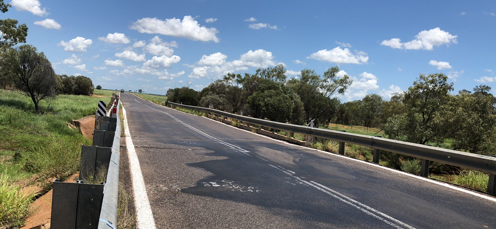
An upgrade is being delivered to a 1.5km section of Proserpine-Shute Harbour Road in Cannonvale.
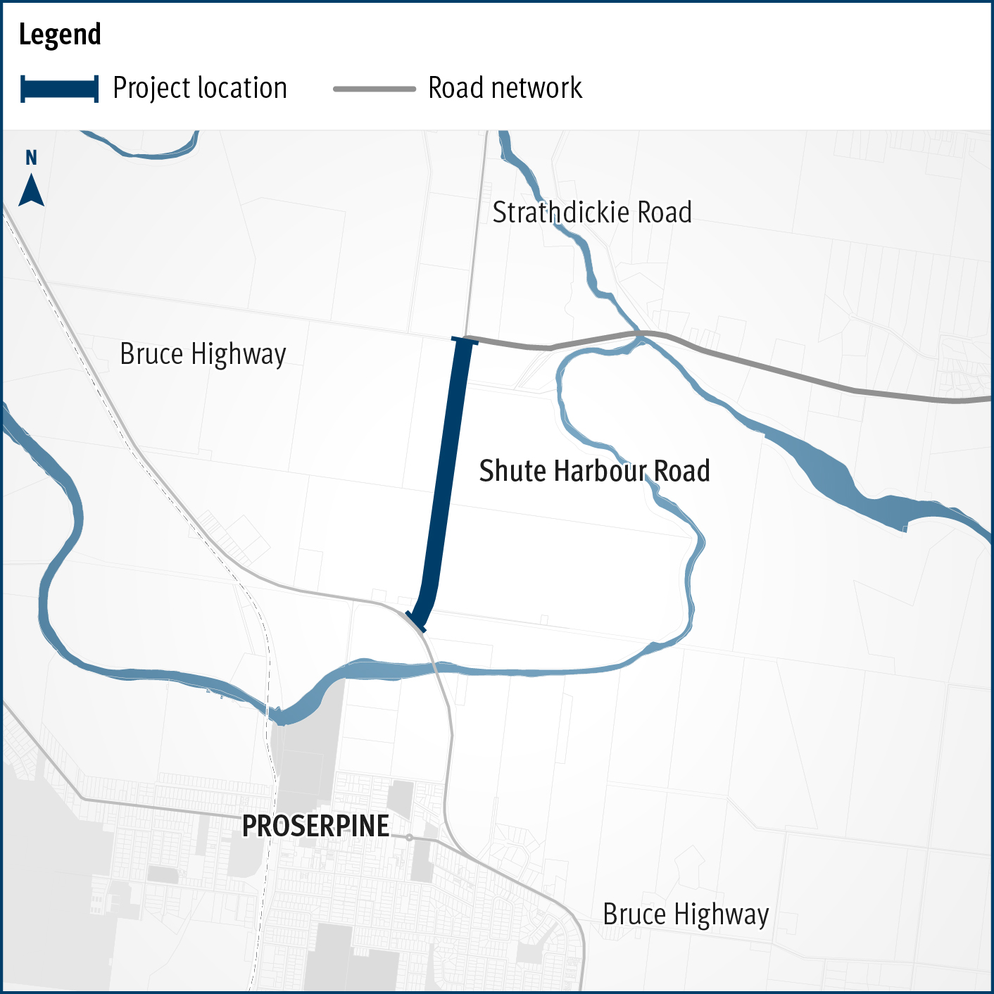
A flood immunity upgrade will be delivered to a 1.5km section of Proserpine – Shute Harbour Road at Hamilton Plains between the Bruce Highway turn-off and Strathdickie Road.

Rockhampton-Yeppoon Road is a regional road linking the Capricorn Coast, including tourist locations, such as Great Keppel Island to Rockhampton and beyond.

Repairs are underway across southern Queensland after extensive and severe damage to the state-controlled road network was caused by multiple heavy rainfall and flooding events in 2022.
Construction will commence this year on a new roundabout at the intersection of Tin Can Bay Road and Bayside Road, at Tin Can Bay.

A new facility is being constructed in the Maryborough region, to manufacture the Queensland Train Manufacturing Program fleet.
Work is underway on flood immunity and intersection upgrades along sections of Torbanlea – Pialba Road between Beelbi Creek and Takura.
Last updated: 30 May 2024