
Banyo level crossing precinct upgrade
We have investigated safety and congestion improvements for the Banyo level crossing precinct.
Accelerated funding has been allocated through the following Road Stimulus Packages to increase investment in roads and transport infrastructure as part of The Queensland Economic Recovery Strategy.
Together with the Australian Government, we are improving Queensland's inland freight corridors by investing $185 million across 22 projects. The Roads of Strategic Importance early works package projects are jointly funded by the Australian and Queensland Governments.
These projects will help the freight and logistic industry move essential goods throughout Queensland more efficiently while protecting the safety of all road users.
Project works include:
View details of all jointly-funded Roads of Strategic Importance early works package projects.
The Queensland Government is investing $400 million across 42 projects to help supercharge the Queensland economy and improve road safety.
Project works include:
View details of all Queensland Government funded Road Stimulus package projects.
Together with the Australian Government, we are fast-tracking infrastructure upgrades by investing $415 million across 38 projects. These projects are jointly funded by the Australian and Queensland Governments.
These infrastructure upgrades will help improve congestion on some of Queensland's busiest roads, increase productive and improve safety for all road users.
Infrastructure upgrades include:
View details of all jointly-funded Australian Government stimulus package projects.
In addition to the $415 million package previously announced, the Queensland Government is partnering with the Australian Government to invest a further $2.1 billion towards infrastructure projects in Queensland, including:

We have investigated safety and congestion improvements for the Banyo level crossing precinct.
The Bayside and Redlands Transport and Mobility Study will investigate opportunities to enhance movement to, from and within the study area.
The Beams Road rail level crossing project will reduce congestion and address safety concerns. The current rail level crossing on Beams Road will be replaced with an overpass to separate road and rail.
The department is designing an upgraded link for bicycle riders and pedestrians between Kurilpa Bridge and Victoria Bridge on the Bicentennial Bikeway.

A preferred option has been identified to reduce congestion and address safety concerns at Boundary Road, Coopers Plains rail level crossing.
Planning is underway to deliver more benefits to our customers by integrating Brisbane Metro into the Woolloongabba precinct and connecting Brisbane's busway network with Cross River Rail.

The Bruce Highway - Gateway Motorway to Dohles Rocks Road (Stage 1) project is part of integrated planning for the Gateway Motorway and Bruce Highway Upgrades in north Brisbane and the Moreton Bay Region.
The Bruce Highway - Gateway Motorway to Dohles Rocks Road (Stage 2) project is part of integrated planning for the Gateway Motorway and Bruce Highway Upgrades in north Brisbane and the Moreton Bay Region.
This project will provide Intelligent Transport System infrastructure at various locations along the Bruce Highway between Pine River and Cairns.
The Bulimba Peninsula Transport and Congestion Study identified community priorities to improve transport options and outcomes for the Bulimba Peninsula.
The Cannon Hill Shopping Centre bus facility is proposed to be upgraded.

3 high priority sections of the Capricorn Highway between Emerald and Alpha have been widened.

Works will involve pavement widening and sealing of various sections of the Carnarvon Highway between 85.16km and 87.44km east of St George.

The Centenary Bridge Upgrade in Jindalee will increase capacity and improve safety on the Centenary Bridge by building a new 3-lane northbound bridge and rehabilitating the existing bridges to 3 lanes southbound including upgrades to active transport facilities.
The department is working with Ipswich City Council to upgrade the Centenary Motorway exit ramp (Exit 32), and the Main Street and Springfield Greenbank Arterial Road intersection, to manage congestion and improve safety at the exit ramp.

The department is developing a masterplan for the Centenary Motorway corridor between Darra and Toowong to improve safety, travel-time and meet the increasing transport demands of the community.
The department is upgrading Cleveland-Redland Bay Road, between Anita Street and Giles Road in Redland Bay.
The department is undertaking a $110 million package of works to upgrade Cleveland-Redland Bay Road.
The department is undertaking planning for the remaining sections of the Ipswich Motorway between Rocklea and Darra.

Planning has started for an interim upgrade of the Cunningham Highway and Ipswich–Rosewood Road intersection in Amberley.
Planning is underway to upgrade the Cunningham Highway.

The Eastern Transitway will provide bus customers in Brisbane's east with a safer and more efficient public transport network. The project will deliver targeted bus priority measures to improve safety, reliability, and capacity along Old Cleveland Road from Coorparoo to Carindale.
The department has delivered 9km of pavement strengthening and widening of the floodway along the Flinders Highway between Julia Creek and Cloncurry at Scrubby Creek.
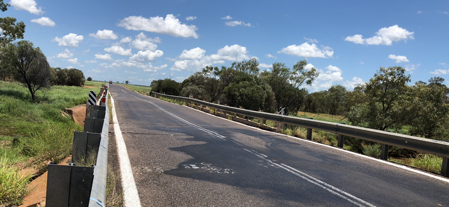
The department is improving the flood immunity and resilience of the state-controlled road network at 27 priority sites.

The Gateway Motorway (Bracken Ridge to Pine River) project is part of integrated planning for the Gateway Motorway and Bruce Highway Upgrades in north Brisbane and the Moreton Bay Region.

Detailed design has started for future expansion of parking facilities at Gaythorne station.
This project has trialled sustainable pavement systems and products to rehabilitate deteriorating sections of the Gore Highway.
The package of Gregory Developmental Road upgrades is delivering a stronger and wider surface, improving travelling conditions for motorists and upgraded a major culvert to improve flood resilience.
The department is replacing a section of noise barriers on the western side of Gympie Arterial Road, north of Strathpine Road in Bald Hills.
Ipswich is a rapidly growing and dynamic local government area. New neighbourhoods are emerging and existing communities continue to expand and mature. People's travel behaviours and expectations around a wider range of travel choices and modes are changing.
We have started the next stage of planning for a future Ipswich to Springfield public transport corridor.
The department undertook community consultation in early 2021 on a proposed improvement for the Ipswich-Cunningham Highway Connection Road (Brisbane Road), Chermside Road and Glebe Road (East Ipswich Fiveways) intersection in East Ipswich. The proposed upgrade included changing Glebe Road into a cul-de-sac to improve safety and traffic flow.
A study has been undertaken to investigate a bypass at Fig Tree Pocket using the existing preserved corridor.
The department has delivered 48km of new sealing along the Kennedy Developmental Road between The Lynd to Hughenden.
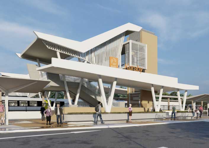
Kuraby station is being upgraded to improve accessibility, safety and customer experience for the community.
We are working with all levels of government to improve safety and accessibility at the Lindum Station and level crossing.
The department has been investigating options to reduce traffic congestion and improve safety and freight access for the Linkfield Road Overpass in Bald Hills.

The Manly Boat Harbour is an integral part of the bayside’s social, cultural and economic landscape. We are currently undertaking a master planning process to help guide future activities at the boat harbour.

Planning is underway to improve active transport infrastructure and safety along Moggill Road.

In 2021, an upgrade was proposed for the Kenmore roundabout at the intersection of Moggill Road and Brookfield Road in Kenmore. The upgrade proposed removing the roundabout and signalising the intersection, and also included provision for active transport users.

The department is undertaking a planning study for Mount Cotton Road, Redland Bay Road and Redland Sub-Arterial Road.
The department is undertaking planning to progressively upgrade the Beaudesert Road corridor, from the Logan Motorway towards Compton Road.

The department is delivering targeted bus priority from Kedron to Chermside, improving the safety and capacity of this important link in Brisbane's northern public transport network.
The department has completed planning which investigated expansion of parking facilities at Northgate station in response to high demand for parking in the local area.
An upgrade is being delivered to a 1.5km section of Proserpine-Shute Harbour Road in Cannonvale.
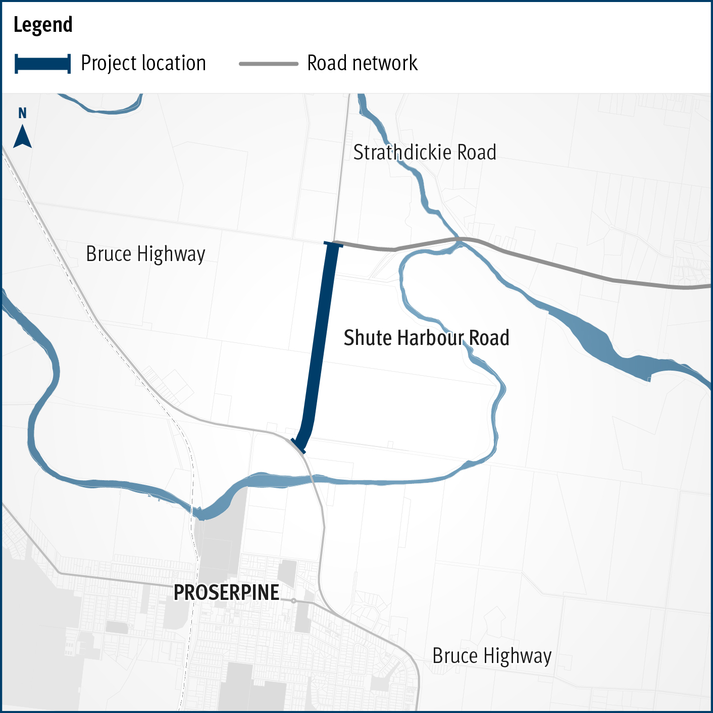
A flood immunity upgrade will be delivered to a 1.5km section of Proserpine – Shute Harbour Road at Hamilton Plains between the Bruce Highway turn-off and Strathdickie Road.
The department is undertaking planning for Mount Cotton Road, Redland Bay Road and the Redland Sub-Arterial Road.

The department is undertaking planning for Mount Cotton Road, Redland Bay Road and the Redland Sub-Arterial Road.
In April 2019, Fulton Hogan and RoadTek were awarded 5-year contracts to undertake responsive maintenance and road asset management services across the Metropolitan Region.

Rockhampton-Yeppoon Road is a regional road linking the Capricorn Coast, including tourist locations, such as Great Keppel Island to Rockhampton and beyond.
We are planning for a proposed passenger rail line between Salisbury and Beaudesert.
Stage 1 of the Salisbury train station park ‘n’ ride is now complete.

Initial community consultation was undertaken on proposed safety and traffic improvement works at key intersections along Samford Road, at Glen Holm Street and Osborne Road.
We conducted a multi-modal study of the ongoing and increasing transport pressures relating to road, active transport and public transport modes in Brisbane’s inner south.
We are working in partnership with Queensland Rail to develop a number of new purpose-built, modern train stabling facilities across the rail network critical to accommodate new trains delivered by the New Generation Rollingstock (NGR) project.

Repairs are underway across southern Queensland after extensive and severe damage to the state-controlled road network was caused by multiple heavy rainfall and flooding events in 2022.
The Stafford Road and South Pine Road Intersection Upgrade planning study delivered a 2-staged concept plan to improve traffic flow and increase capacity. The plan includes safety improvements at Sizer and McIlwraith streets, as well as pedestrian and bike riding upgrades in the area.
The Australian and Queensland governments are working together to deliver the Toowoomba to Brisbane Passenger Rail Strategic Business Case.
Work is underway on flood immunity and intersection upgrades along sections of Torbanlea – Pialba Road between Beelbi Creek and Takura.

The O’Keefe Street velobridge at Woolloongabba is now open.

The Veloway 1 (V1) is a dedicated bikeway designed to connect people riding bikes between Lower River Terrace, South Brisbane and Eight Mile Plains, adjacent to the Pacific Motorway.

The Veloway 1 is a dedicated cycleway running between Lower River Terrace, South Brisbane and Underwood. The 20km cycleway provides a safe and efficient route for bike riders.

The department has completed planning to identify a preferred option for the upgrade of Warrego Highway – Mount Crosby Road interchange.

The Bremer River Bridge project includes critical rehabilitation and strengthening repair works, including bridge re-decking, to extend the life of the existing westbound bridge structure.
The Western Brisbane Transport Network Strategy provided a transport vision for developing a fully integrated transport network for western and north-western Brisbane that caters for walking, cycling, rail, bus, roads and freight.
Last updated: 30 May 2024