Road Stimulus Packages

Accelerated funding has been allocated through the following Road Stimulus Packages to increase investment in roads and transport infrastructure as part of The Queensland Economic Recovery Strategy.

Roads of Strategic Importance early works package

Together with the Australian Government, we are improving Queensland's inland freight corridors by investing $185 million across 22 projects. The Roads of Strategic Importance early works package projects are jointly funded by the Australian and Queensland Governments.

These projects will help the freight and logistic industry move essential goods throughout Queensland more efficiently while protecting the safety of all road users.

Project works include: 

  • sealing roads  
  • building overtaking lanes to improve road safety  
  • upgrade to intersections
  • heavy vehicle breakdown pads.

View details of all jointly-funded Roads of Strategic Importance early works package projects

Queensland Government $400 million road stimulus package

The Queensland Government is investing $400 million across 42 projects to help supercharge the Queensland economy and improve road safety.

Project works include: 

  • intersection upgrades
  • widening of roads
  • sealing key freight routes 
  • upgrade to older bridge and culverts.

View details of all Queensland Government funded Road Stimulus package projects.

Jointly-funded Australian Government $415 million road stimulus package

Together with the Australian Government, we are fast-tracking infrastructure upgrades by investing $415 million across 38 projects. These projects are jointly funded by the Australian and Queensland Governments. 

These infrastructure upgrades will help improve congestion on some of Queensland's busiest roads, increase productive and improve safety for all road users. 

Infrastructure upgrades include: 

  • bridge and culvert upgrades
  • upgrade to floodways
  • widening of roads
  • sealing of roads.

View details of all jointly-funded Australian Government stimulus package projects.

Jointly-funded $2.1 billion stimulus package

In addition to the $415 million package previously announced, the Queensland Government is partnering with the Australian Government to invest a further $2.1 billion towards infrastructure projects in Queensland, including:

  • $1.5 billion for the Coomera Connector Stage 1 (Coomera to Nerang)
  • $248 million for the Beams Road level crossing, including the Carseldine park'n'ride upgrade
  • $224 million for the Centenary Bridge Stage 1 Upgrade
  • $95 million for the Riverway Drive Stage 2 (Allambie Lane - Dunlop Street)
  • $53 million for the Mt Lindesay Highway - Johanna Street to South Street
  • $20 million for the M1 Pacific Motorway Upgrade Program - Exit 45
  • $4 million for the Currumbin Creek Road-Bienvenue Drive Intersection Upgrade.

Benefits

  • Contributes to economy
  • Contributes to regional growth
  • Improves safety
  • Reduces peak hour congestion
  • Improves flood immunity
  • Better road access

38 Projects in Road Stimulus Packages

No image supplied

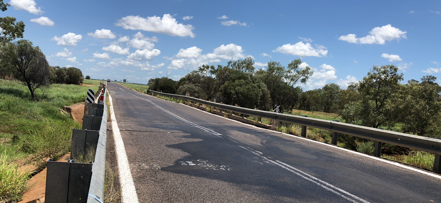
Barwon Highway (Talwood - Nindigully) Weengallon, pavement widening

Pavement widening on the Barwon Highway has been completed to improve road safety, reduce ongoing maintenance demand and provide a better driving experience for road users in the area.

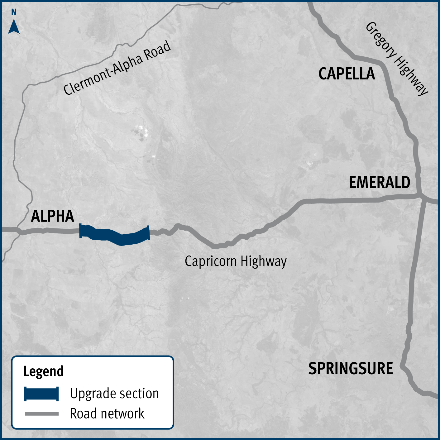
Capricorn Highway (Emerald - Alpha), widen pavement project map

Capricorn Highway (Emerald - Alpha), widen pavement

3 high priority sections of the Capricorn Highway between Emerald and Alpha have been widened.

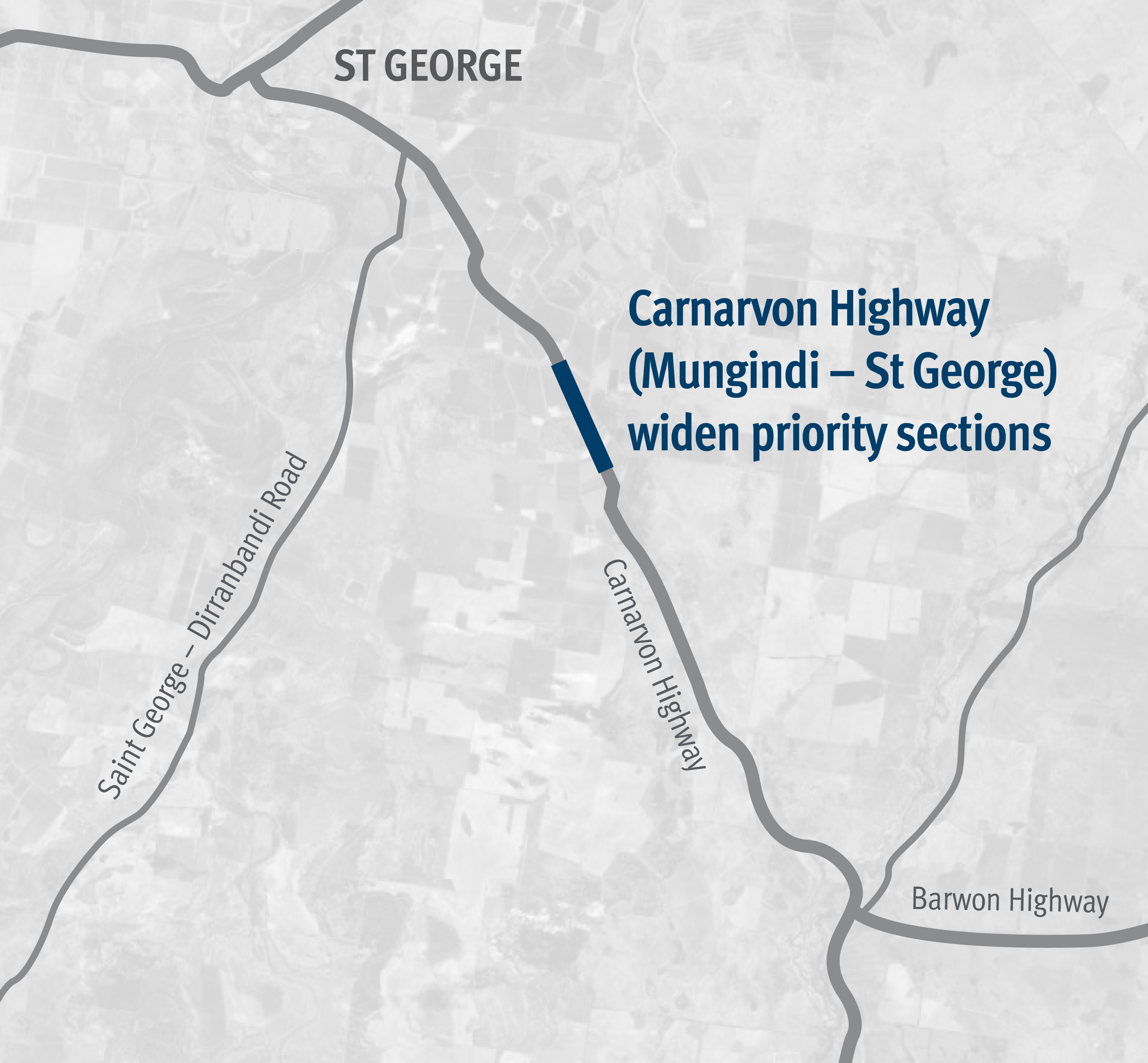
Carnarvon Highway Mungindi St George project map

Carnarvon Highway (Mungindi – St George), widen and seal

Works will involve pavement widening and sealing of various sections of the Carnarvon Highway between 85.16km and 87.44km east of St George.

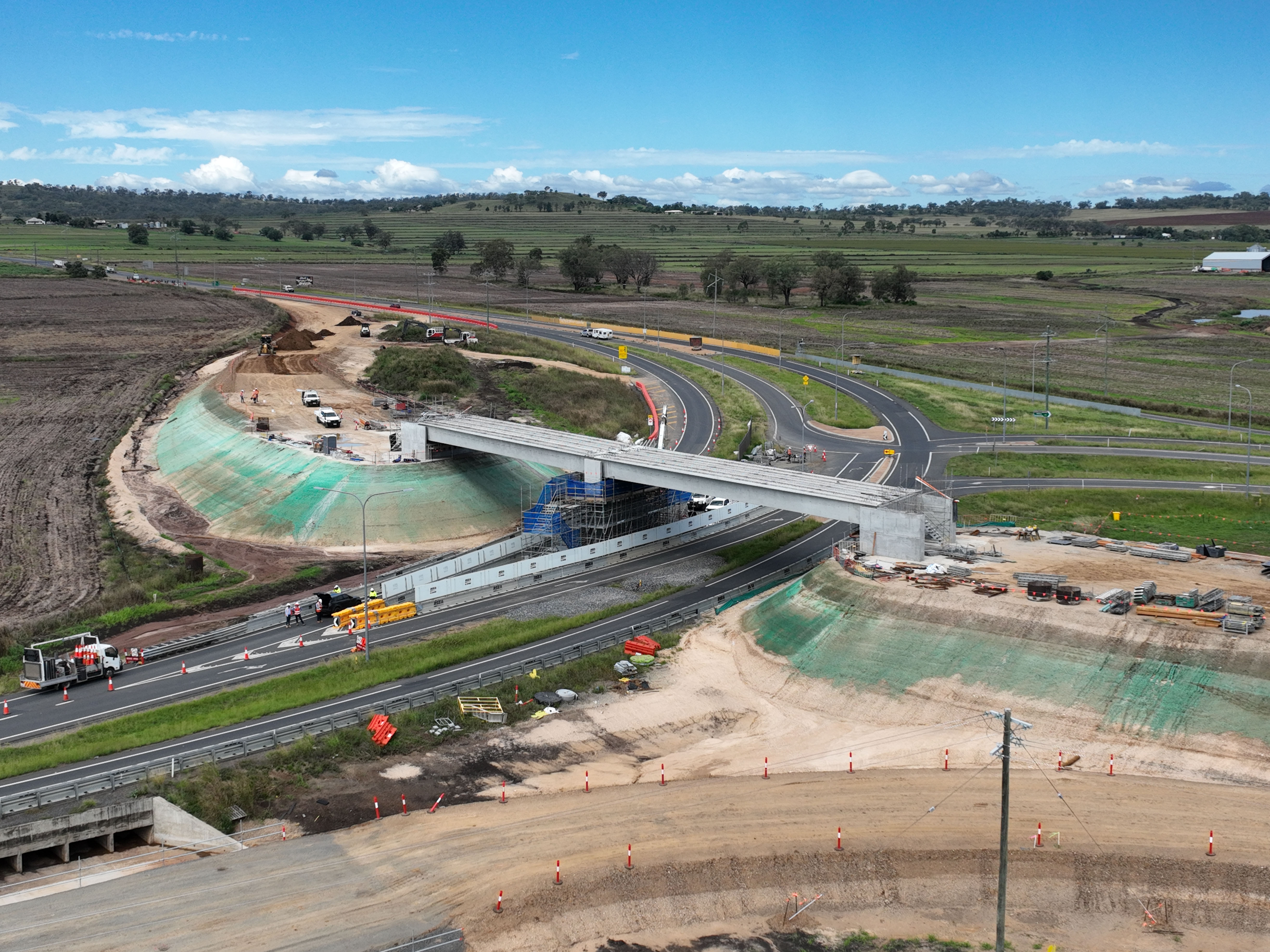
Image showing construction on the new overpass at Eight Mile intersection in March 2022.

Cunningham Highway (Ipswich - Warwick), Eight Mile intersection upgrade

A major intersection upgrade to improve safety at the Cunningham and New England highways intersection is complete.

No image supplied

Cunningham Highway (Ipswich – Warwick), Tregony to Maryvale, improve safety and Cunningham Highway (Ipswich – Warwick), various locations, improve safety

The project involves investigating safety improvements to provide a better driving experience for all road users and reduce the risk of fatal and serious injury crashes.

No image supplied

Cunningham Highway (Warwick – Inglewood), improve safety

This project involves investigating safety improvements to provide a better driving experience for all road users and reduce the risk of fatal and serious injury crashes.

Scrubby Creek looking west pre-construction

Flinders Highway (Julia Creek – Cloncurry), Scrubby Creek, pavement, strengthening and widening of floodway

The department has delivered 9km of pavement strengthening and widening of the floodway along the Flinders Highway between Julia Creek and Cloncurry at Scrubby Creek.  

Flood resilience works

The department is improving the flood immunity and resilience of the state-controlled road network at 27 priority sites.

No image supplied

Gatton-Helidon Road, pavement widening

Traffic flow and safety are being improved on Gatton-Helidon Road.

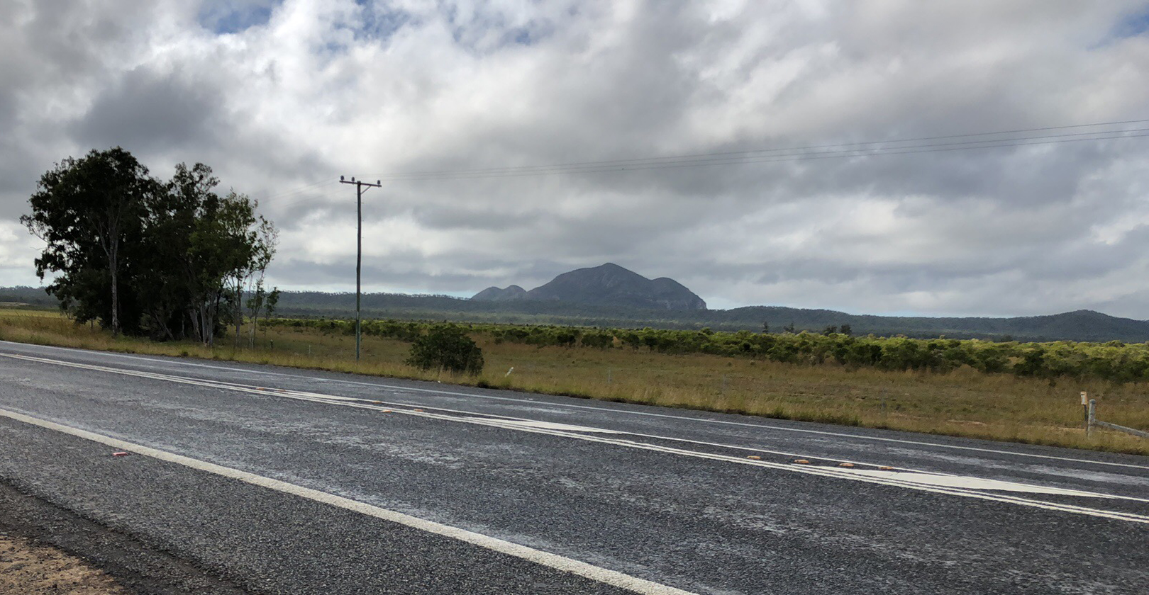
Gatton–Clifton Road Realignment Planning, Mount Whitestone location

Gatton–Clifton Road Realignment Planning, Mount Whitestone

This planning project aims to identify a new permanent alignment for Gatton–Clifton Road to bypass a 400m section that is affected and at-risk from a large and slow-moving landslip at Mount Whitestone.

No image supplied

Gore Highway (Millmerran – Goondiwindi), Wyaga Creek, upgrade floodway

A new bridge at Wyaga Creek crossing on the Gore Highway will improve flood immunity, safety and efficiency on one of Queensland's most important transport links.

No image supplied

Gore Highway (Pittsworth - Millmerran), various locations, rehabilitate pavement

This project has trialled sustainable pavement systems and products to rehabilitate deteriorating sections of the Gore Highway.

No image supplied

Gregory Developmental Road (Charters Towers - Lynd), package of works

The package of Gregory Developmental Road upgrades is delivering a stronger and wider surface, improving travelling conditions for motorists and upgraded a major culvert to improve flood resilience.

No image supplied

Kennedy Developmental Road—(The Lynd-Hughenden) upgrade

The department has delivered 48km of new sealing along the Kennedy Developmental Road between The Lynd to Hughenden.

Murphys Creek Road ROcky Creek Bridge replacement project location map.

Murphys Creek Road, Rocky Creek Bridge, replace bridge

Rocky Creek Bridge was replaced to improve safety, traffic flow, flood immunity and efficiency.

Map of project location on the New England Highway (Ruthven Street) between James Street and Nelson Street in Toowoomba

New England Highway (Toowoomba - Warwick), high risk roads, improve safety

Construction is complete to improve safety on Ruthven Street in Toowoomba's south.

No image supplied

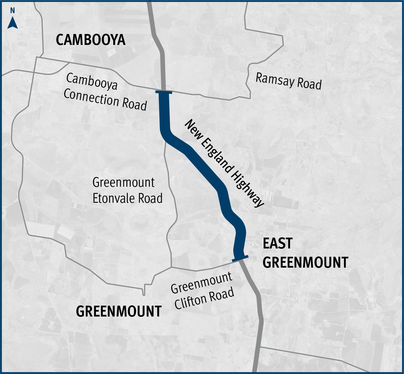
New England Highway (Toowoomba-Warwick) Hodgson Creek to Cambooya Connection Road – options analysis

This planning project involved investigating ways to improve safety and efficiency on the New England Highway between Hodgson Creek and the southern side of Cambooya Connection Road.

New England Highway (Toowoomba-Warwick) business cases location map

New England Highway (Toowoomba-Warwick) business cases

The planning projects investigated future infrastructure to improve safety and efficiency on the New England Highway, south of Toowoomba.

The map shows the locality of works completed to improve safety on the New England Highway between Stanthorpe and Ballandean. Solid dark blue lines indicate eight packages of work. Places included on the map from north to south include Stanthorpe, Glen Aplin and Ballandean. The maps also indicates the location of select roads that intersect with New England Highway including Texas Road, Wallangarra Road, Back Creek Road, Kerridges Road, Glen Aplin Drive, Sutton Lane, Fletcher Road and Eukey Road.

New England Highway (Warwick - Wallangarra), high risk roads, improve safety

The department has delivered pavement widening and resurfacing works to improve safety and freight efficiency on the New England Highway between Stanthorpe and Ballandean.

No image supplied

New England Highway (Yarraman - Toowoomba), Back Creek bridge, upgrade bridge and approaches, planning

The department has a planning project underway to investigate safety improvements at Back Creek on the New England Highway south of Cooyar.

No image supplied

New England Highway (Yarraman - Toowoomba), Borneo Barracks (Cabarlah), construct turning lanes

The department is working with the Department of Defence to upgrade the entrance to the Borneo Barracks from the New England Highway at Cabarlah.

Bikeway between Mitchell Road and Toowoomba Christian College.

New England Highway Bikeway, Highfields to Toowoomba CBD (Stages 1,2 & 3)

The bikeway project will connect Highfields to Toowoomba, providing a safer and more accessible active transport option.

New England Highway Cooyar to Bum Bum Creek

New England Highway—(Yarraman-Toowoomba), widen pavement

The upgrade of the New England Highway between Cooyar and Bum Bum Creek has been completed, delivering critical safety and efficiency improvements south of Yarraman.

No image supplied

Oakey-Pittsworth Road, various locations, business case

Planning is underway to improve safety, efficiency and reliability of Oakey-Pittsworth Road.

No image supplied

Proserpine - Shute Harbour Road, Paluma Road to Tropic Road (Cannonvale), duplication

An upgrade is being delivered to a 1.5km section of Proserpine-Shute Harbour Road in Cannonvale.

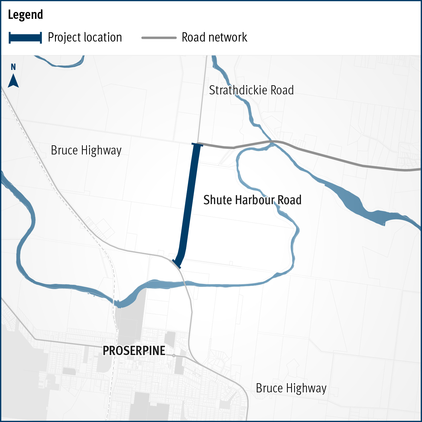
Proserpine – Shute Harbour Road, Hamilton Plains, flood immunity upgrade

A flood immunity upgrade will be delivered to a 1.5km section of Proserpine – Shute Harbour Road at Hamilton Plains between the Bruce Highway turn-off and Strathdickie Road.

image of a section of Yeppoon Road

Rockhampton–Yeppoon Road, Yeppoon Road Upgrade Project

Rockhampton-Yeppoon Road is a regional road linking the Capricorn Coast, including tourist locations, such as Great Keppel Island to Rockhampton and beyond. 

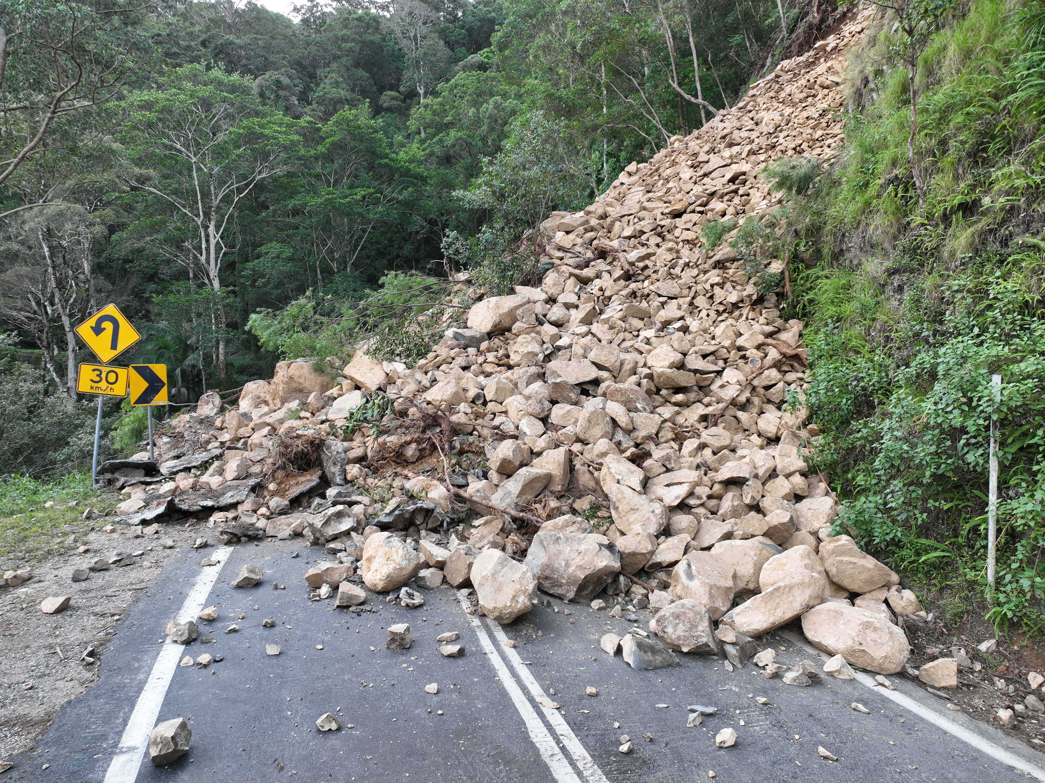
Landslip on Gold Coast - Springbrook Road

Southern Queensland 2022 flood reconstruction works

Repairs are underway across southern Queensland after extensive and severe damage to the state-controlled road network was caused by multiple heavy rainfall and flooding events in 2022.

No image supplied

Toowoomba - Cecil Plains Road, Taylor Street cycleway, business case

This planning project established a long-term vision to provide suitable active transport facilities between Tor and Boundary streets encourage more people to ride more often.

No image supplied

Toowoomba Central Active Transport Link, business case

Planning is underway for another key link in Toowoomba's Principal Cycle Network.

No image supplied

Toowoomba North South Transport Corridor Planning – Charlton Bypass

The department has finalised planning on the Toowoomba North South Transport Corridor.

No image supplied

Toowoomba to Brisbane Passenger Rail Strategic Business Case

The Australian and Queensland governments are working together to deliver the Toowoomba to Brisbane Passenger Rail Strategic Business Case.

Thumbnail image showing map of project area for proposed extension for Inland Rail from Toowoomba to Gladstone

Toowoomba to Gladstone Inland Rail Extension Business Case

The Australian and Queensland governments are working together to deliver the Toowoomba to Gladstone Inland Rail Extension Business Case.

No image supplied

Toowoomba–Cecil Plains Road, improve safety

Detailed design commenced in October 2023 and is expected to be completed in June 2024.

No image supplied

Torbanlea – Pialba Road, various locations, upgrade intersections and floodways

Work is underway on flood immunity and intersection upgrades along sections of Torbanlea – Pialba Road between Beelbi Creek and Takura.

No image supplied

Warrego Highway East master plan – Ipswich to Toowoomba

The Warrego Highway East master plan project will determine the future requirements of the Warrego Highway transport corridor.

Image of Warwick principal cycle network plan, business case locations. Cunningham Highway and Dragon Street intersection, and the New England Highway and Pratten Street intersection.  Dragon, Pratten and Easey streets.

Warwick principal cycle network plan, business case

This project is part of a state-wide strategy to help improve bicycle riding facilities and networks in Warwick to increase active transport.