
Mount Lindesay Highway Upgrade Program
Interactive map for Mount Lindesay Highway 10 year investment plan...
Interactive map for Mount Lindesay Highway 10 year investment plan...

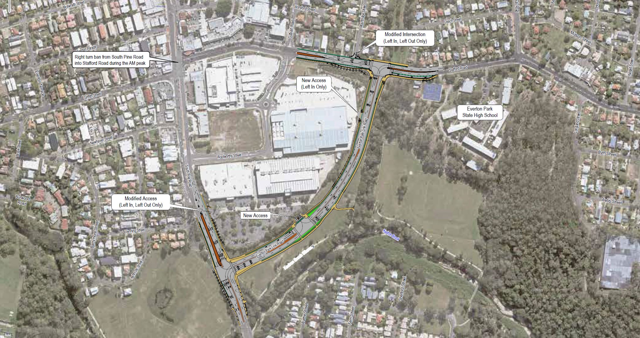
We will deliver the Everton Park Link Road to connect South Pine Road to Stafford Road...
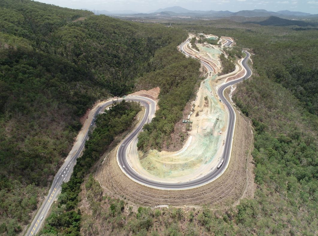
Eton Range fully opened to traffic on 1 October 2020. The existing range has been upgraded to 4 lanes, added a split carriageway for part of the range and reduced the grade to improve safety and...
Planning project to investigate and prioritise upgrades to the Bruce Highway between the Pine River and Caloundra Road...
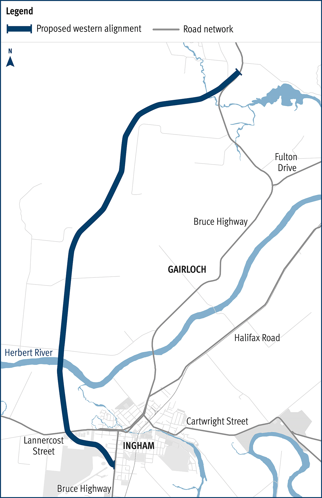
The department has been actively working with the community to address the challenges associated with the Bruce Highway from South of Ingham to the Cardwell Range...
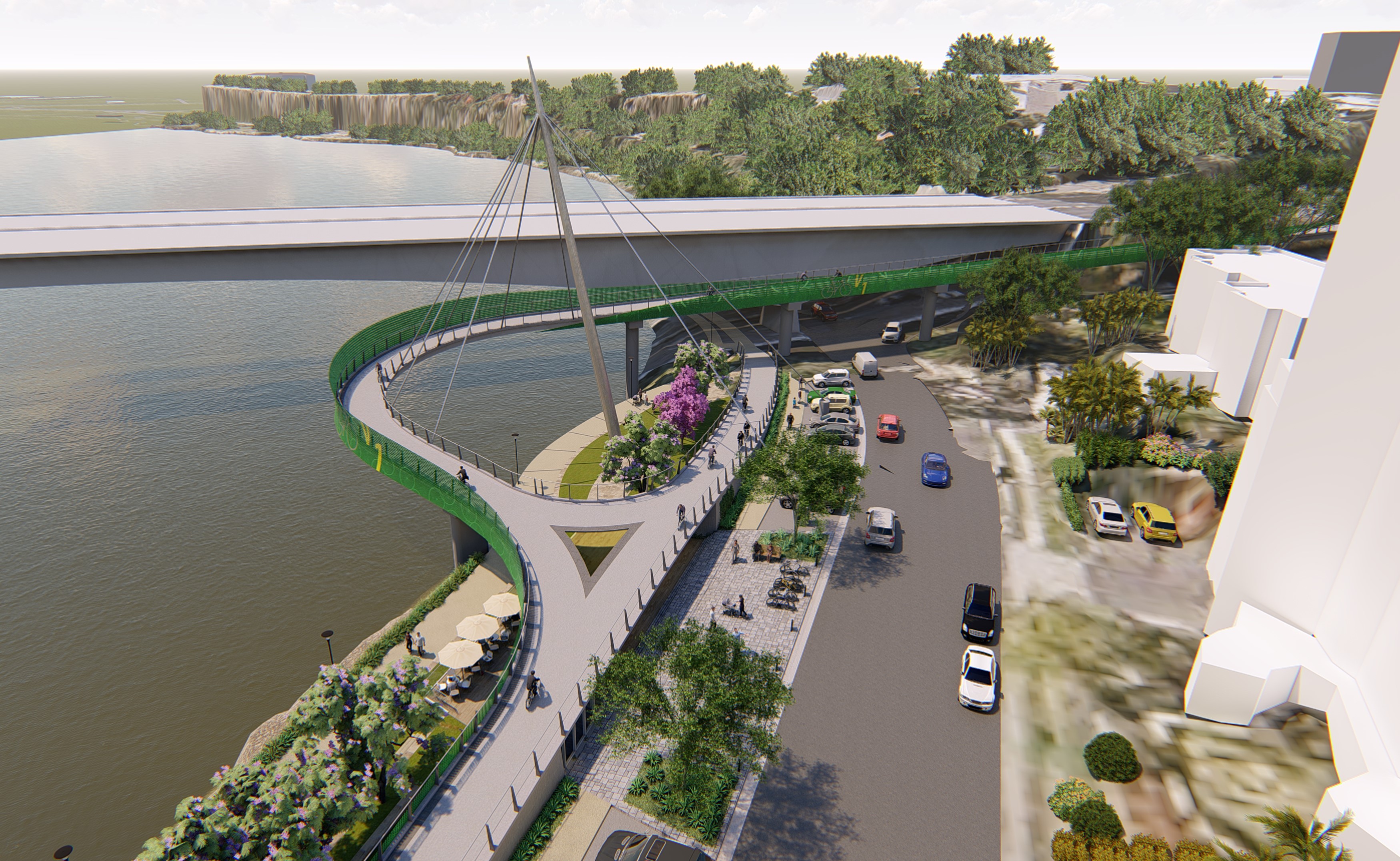
The Veloway 1 (V1) is a dedicated bikeway designed to connect people riding bikes between Lower River Terrace, South Brisbane and Eight Mile Plains, adjacent to the Pacific Motorway...
The Department of Transport and Main Roads undertaking safety improvements on Beaudesert–Beenleigh Road...
We are upgrading the highway, and major intersection upgrades, north of Mackay to reduce congestion and improve traffic flow in critical areas...
The Western Brisbane Transport Network Strategy provided a transport vision for developing a fully integrated transport network for western and north-western Brisbane that caters for walking, cycling...
Queensland Rail in partnership with The Department of Transport and Main Roads, is developing a number of new purpose-built, modern train stabling facilities across the rail network critical to...