Showing results 1-10 of 24

Sort results
Sort results
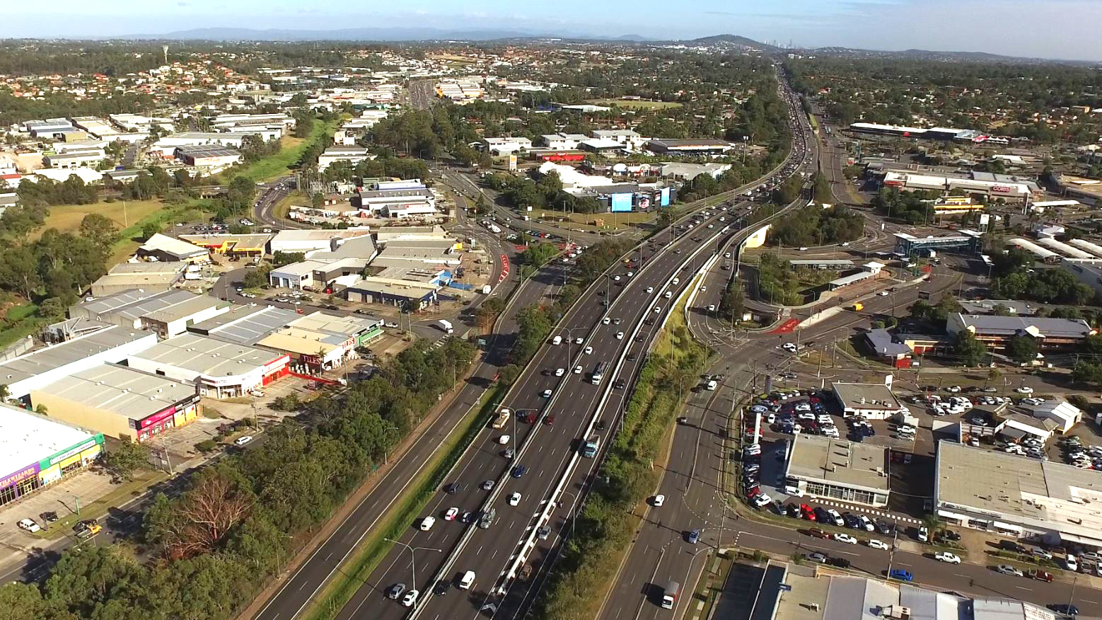
  1. Brisbane–Beenleigh Road, Loganlea Road to Waterford–Tamborine Road, business case

    The department is undertaking a business case for a potential future project on Brisbane–Beenleigh Road, between the intersections of Loganlea Road and Waterford–Tamborine Road. The community is...

    No image supplied
  2. Samford Sub-Arterial Road (Samford Road) and Glen Holm Street, upgrade intersection and Samford Sub-Arterial Road (Samford Road) and Osborne Road intersection planning (known as the Samford Road intersection improvements)

    We are currently undertaking community consultation on proposed safety and traffic improvement works at key intersections along Samford Road, at Pickering Street, Glen Holm Street and Osborne Road...

    Map of Samford Road interection improvements
  3. Loganlea train station and park 'n' ride relocation

    We are relocating Loganlea Station and the park ‘n’ ride closer to Logan Hospital...

    Artist impression of the proposed upgraded Loganlea station. Image is looking from Station Road and shows the new wider underpass with people out the front of the new station building and trains pulled up at the platforms.
  4. Cunningham Arterial Road (Ipswich Motorway) Rocklea to Darra, remaining sections, planning

    Upgrading Cunningham Arterial (Ipswich Motorway), Rocklea to Darra,...

    No image supplied
  5. Landsborough to Nambour Rail Corridor Study

    The department has identified and preserved a new rail corridor between Landsborough and Nambour, which will replace the existing North Coast line through this section...

    No image supplied
  6. Bruce Highway Upgrade—Sunshine Motorway to Maroochydore Road

    We have completed early planning to determine future upgrade needs for the Bruce Highway between the Sunshine Motorway and Maroochydore Road...

    No image supplied
  7. Gowrie to Grandchester Rail Corridor Study

    The Gowrie to Grandchester Rail Corridor Study investigated a rail corridor that would help mitigate the constraints on rail operations caused by the Toowoomba and Little Liverpool Range crossings...

    No image supplied
  8. Cooroy intersection improvements

    We are finalising planning for the upgrade of the intersections at Diamond and Elm Streets and Myall and Elm Streets at Cooroy...

    Diamond and Elm Street
  9. Pacific Motorway (M1) – Daisy Hill to Logan Motorway upgrade

    We have started work on the business case for the Pacific Motorway (M1) – Daisy Hill to Logan Motorway upgrade...

    Aerial view of Pacific Motorway through Springwood
  10. Bruce Highway, (Ingham – Innisfail) Ingham to Cardwell Range Deviation, plan and preserve corridor

    The department has been actively working with the community to address the challenges associated with the Bruce Highway from South of Ingham to the Cardwell Range...

    The map shows the locality of the existing Bruce Highway, from south of Ingham, north through the Gairloch floodway and up to the Cardwell Range. Cardwell is northeast of the map. A solid dark blue line west of the Bruce Highway indicates the current proposed Ingham to Cardwell deviation project corridor. This is known as the Western 2A Deviation, which has been gazetted as future state-controlled road. The local road network, including Halifax Road and Lannercost Street are also highlighted on the map.
Previous Page (disabled)
  1. Page 1
  2. Page 2
  3. Page 3