Showing results 1-10 of 63

Sort results
Sort results
  1. Maroochydore - Mooloolaba Road and Ocean Street, improve intersection

    Horton Parade Maroochydore Road Ocean Street and Beach Road intersection pedestrian safety improvements...

    No image supplied
  2. Murphys Creek Road, Rocky Creek Bridge, replace bridge

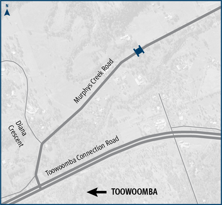
    The Department of Transport and Main Roads is replacing Rocky Creek bridge on Murphys Creek Road at Postmans Ridge, with a two-lane concrete bridge...

    Murphys Creek Road ROcky Creek Bridge replacement project location map.
  3. Bruce Highway (Ingham – Innisfail), Smiths Gap, construct southbound overtaking lane and fauna overpass

    The Department of Transport and Main Roads is progressing a project to build a southbound overtaking lane at Smiths Gap on the Bruce Highway. The project will include the construction of a fauna...

    No image supplied
  4. Kennedy Highway (Cairns - Mareeba), Kuranda Range, Intelligent Transport System

    Installation of additional Intelligent Transport Systems (ITS) treatments on Kuranda Range Road has been completed...

  5. Cunningham Highway (Ipswich - Warwick), Eight Mile intersection upgrade

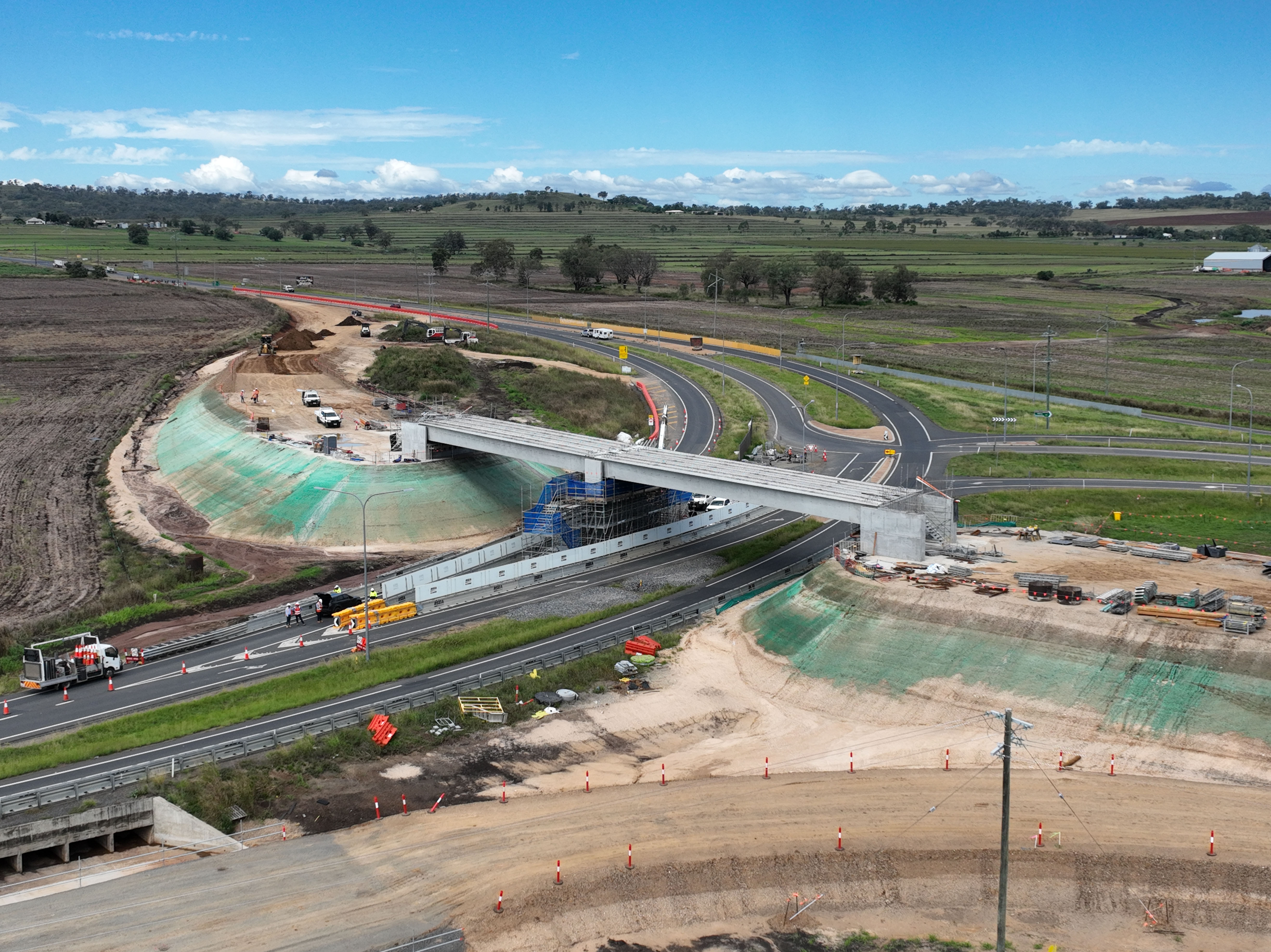
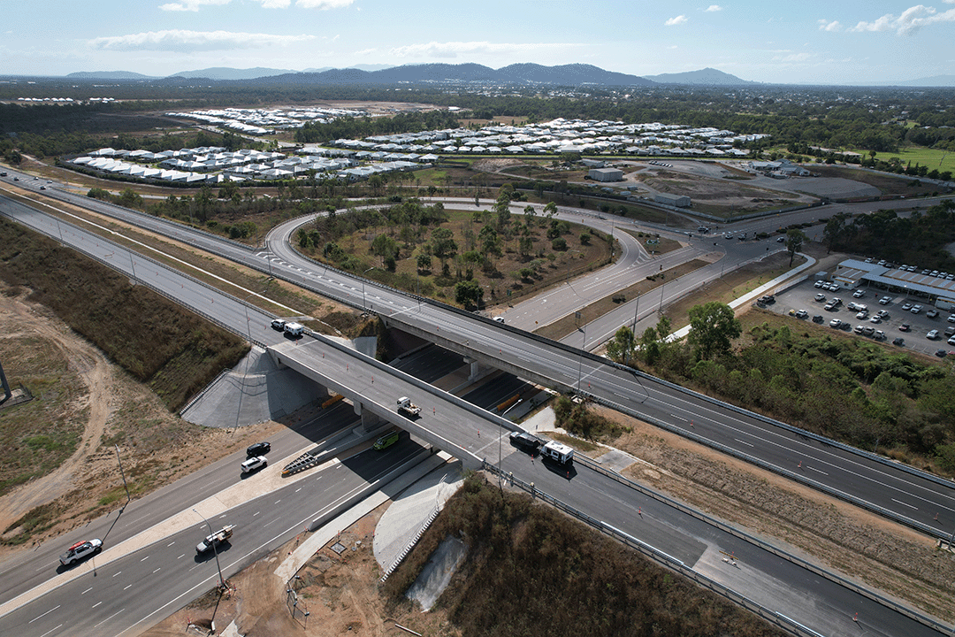
    The Eight Mile intersection upgrade will improve safety and transport efficiency for road users in the area...

    Image showing construction on the new overpass at Eight Mile intersection in March 2022.
  6. Bruce Highway (Mackay – Proserpine), Goorganga Plains, plan and preserve

    This project involves preparing a business case to upgrade the immunity of the Bruce Highway at the Goorganga and Myrtle Creek floodplains, located 4kms south and 6kms north of Proserpine...

    No image supplied
  7. Bruce Highway (Bowen – Ayr), Bowen Connection Road to Champion Street intersection, widen pavement

    The project will deliver safety upgrades to almost 6 kilometres of the Bruce Highway between the Bowen Connection Road and Champion Street intersections. Additionally, the Bruce Highway and Don Street...

    No image supplied
  8. Townsville Ring Road (Stage 5)

    Construction started in June 2021 and was completed in early October 2023...

    Hervey Range Developmental Road interchange (looking north), photo shows two overpasses and traffic traveling across the overpasses and underneath
  9. Clontarf - Anzac Avenue (Elizabeth Avenue), construct active transport overpass

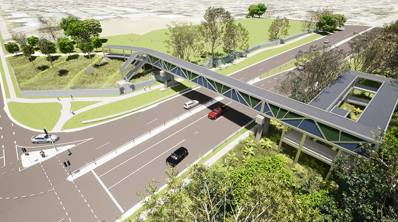
    We are constructing a pedestrian overpass on Elizabeth Avenue, Clontarf—35m south of King Street intersection—to improve safety of school students and community who are crossing this busy road...

    Thumbnail image of artist impression of overpass
  10. Beaudesert – Nerang Road and Yalkuri Drive, upgrade intersection

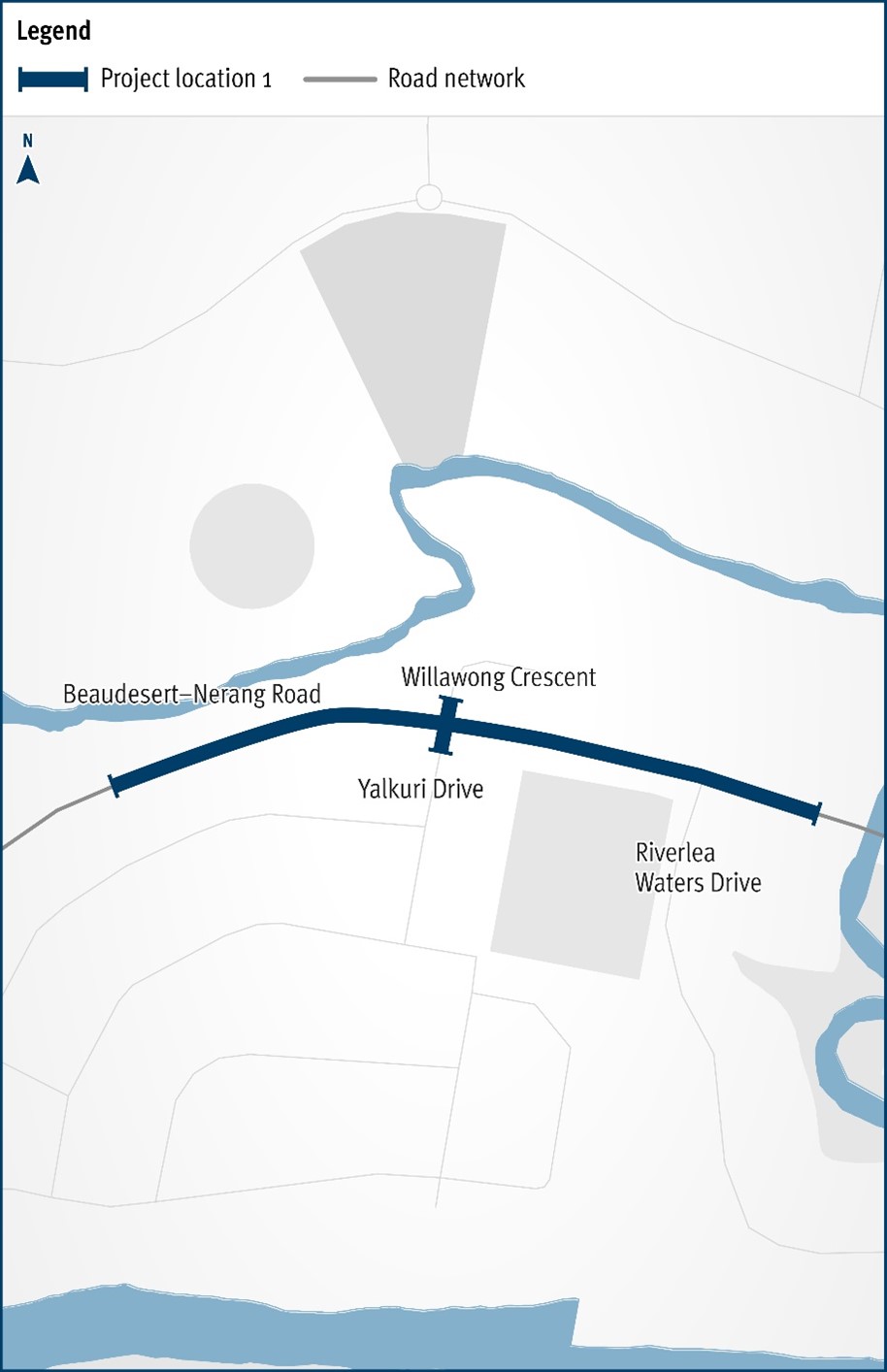
    The Department of Transport and Main Roads will be improving the safety and efficiency of the Beaudesert–Nerang Road, Yalkuri Drive and Willawong Crescent intersection at Nerang...

    The map shows the locality of the proposed Beaudesert-Nerang Road, Yalkuri Drive and Willawong Crescent intersection upgrade. Beaudesert is located to the west and Nerang to the east of the project location. A solid dark blue line indicates the project extent, which encompasses Yalkuri Drive south of the intersection and Willawong Crescent north of the intersection, as well as Beaudesert–Nerang Road, which is located west and east of the intersection. The local road network, Riverlea Waters Drive is also highlighted on the map.
Previous Page (disabled)
  1. Page 1
  2. Page 2
  3. ...
  4. Page 7