Showing results 11-20 of 32

Sort results
Sort results
  1. Barcaldine-Aramac Road, rehabilitate and widen pavement

    About 20km of the Barcaldine-Aramac Road has been gradually widened to improve travelling conditions...

    No image supplied
  2. Mackay Northern Access Upgrade, construct additional lanes

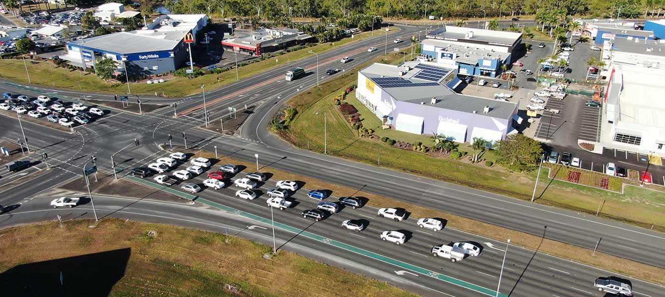
    We are upgrading the highway, and major intersection upgrades, north of Mackay to reduce congestion and improve traffic flow in critical areas...

    Mackay Northern Access
  3. Eyre Developmental Road (Bedourie - Birdsville), pave and seal

    Around 35km of the 185km road is being sealed to improve safety, connectivity and wet weather access...

    No image supplied
  4. Bruce Highway (Proserpine – Bowen), Bowen Connection Road, improve intersection

    The project will deliver safety upgrades to almost 6 kilometres of the Bruce Highway between the Bowen Connection Road and Champion Street intersections. Additionally, the Bruce Highway and Don Street...

    No image supplied
  5. Walkerston Bypass

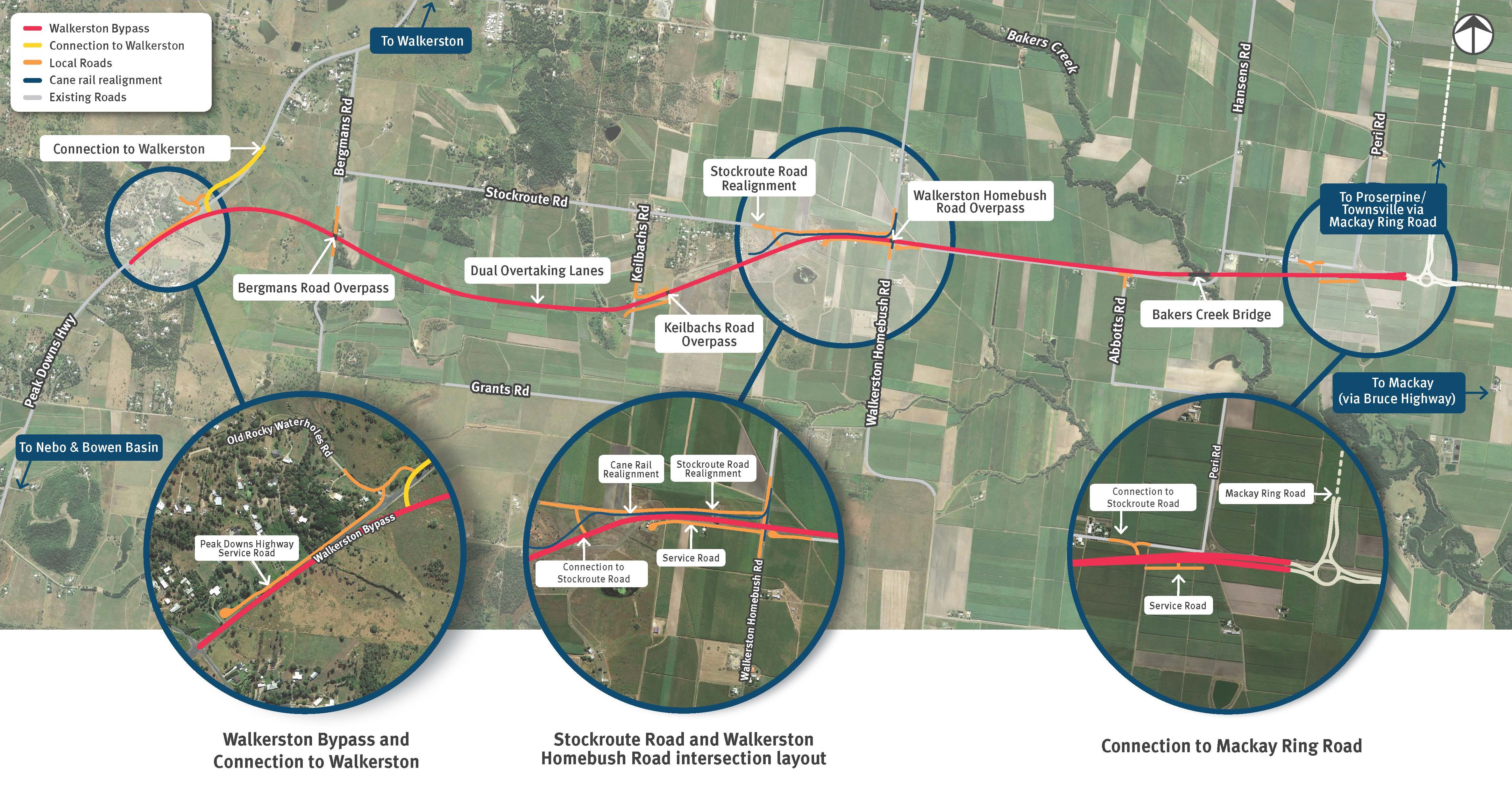
    We are building a new 2-lane rural highway to connect Peak Downs Highway west of Walkerston to the Mackay Ring Road near Paget...

    Walkerston Bypass map detail several upgrades
  6. Cramsie-Muttaburra Road, rehabilitate and widen pavement

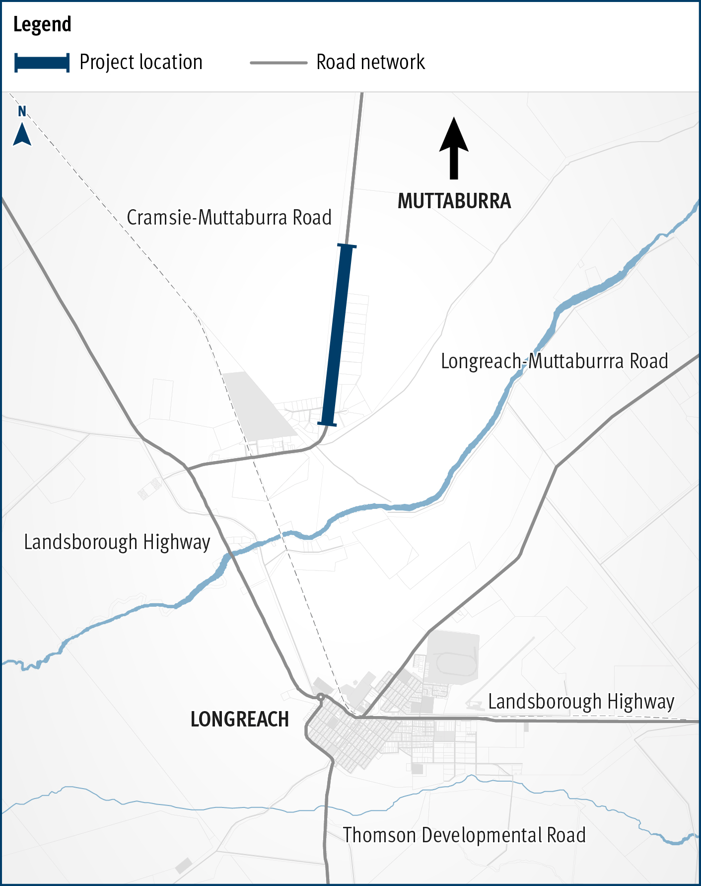
    This project will widen and rehabilitate a 3km section of aged, narrow pavement on the Cramsie-Muttaburra Road to a width of 8m, improving safety, overtaking opportunities and travel times...

    The map shows the location of rehabilitation and widening works underway on a three kilometre section of the Cramsie-Muttaburra Road. The road is situated between Longreach and Muttaburra in Central West Queensland. The map shows the proximity of the works to the Longreach township and includes the surrounding road network, such as the Landsborough Highway and local government-owned Longreach-Muttaburra Road.
  7. Yeppoon Road Upgrade Project Frequently Asked Questions

    General Where is Rockhampton-Yeppoon Road? Rockhampton-Yeppoon Road is a regional road linking the Capricorn Coast to Rockhampton and the Bruce Highway. It also forms part of the designated State...

  8. Long-distance passenger rail business case

    We are preparing a business case to replace the rollingstock on the long distance passenger rail fleet that services western regional Queensland...

    No image supplied
  9. Richmond-Winton Road, pave and seal

    Another 3km of the road is being sealed to improve safety and travel times on this key transport link...

    The map shows the locality of three separate projects on the Richmond-Winton Road delivered as part of a progressive approach to sealing this road. The road is located between Richmond and Winton in western Queensland, with the three projects closest to Winton. Project location 1 is shown by a solid blue line. Project location 2 is shown by a green line with a broken blue line in the centre. Project location 3 is shown by an orange line with a blue line in the centre. The surrounding road network, including the Landsborough Highway and local government owned Corfield-Richmond Road are also shown on the map.
  10. Proserpine – Shute Harbour Road, Hamilton Plains, flood immunity upgrade

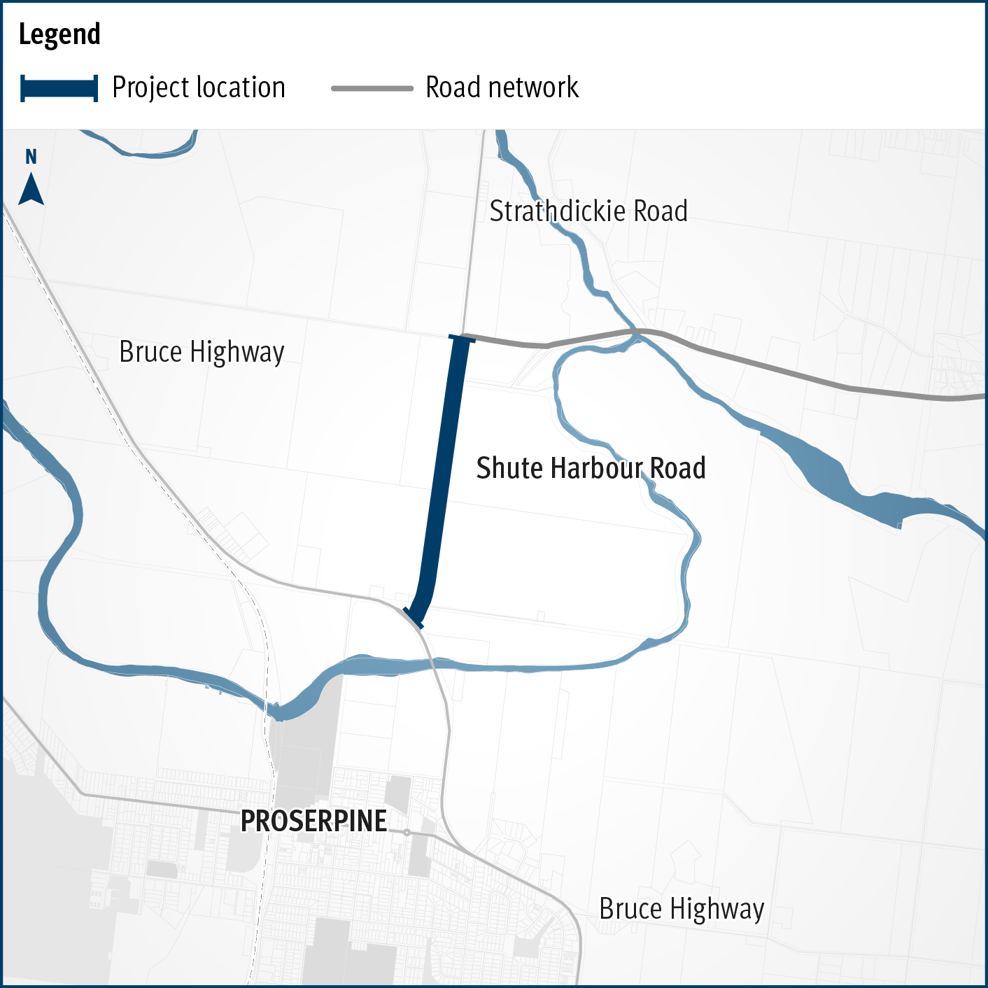
    Proserpine – Shute Harbour Road will benefit from a $21 million flood immunity upgrade at Hamilton Plains between the Bruce Highway turn-off and Strathdickie Road...