Showing results 11-20 of 48

Sort results
Sort results
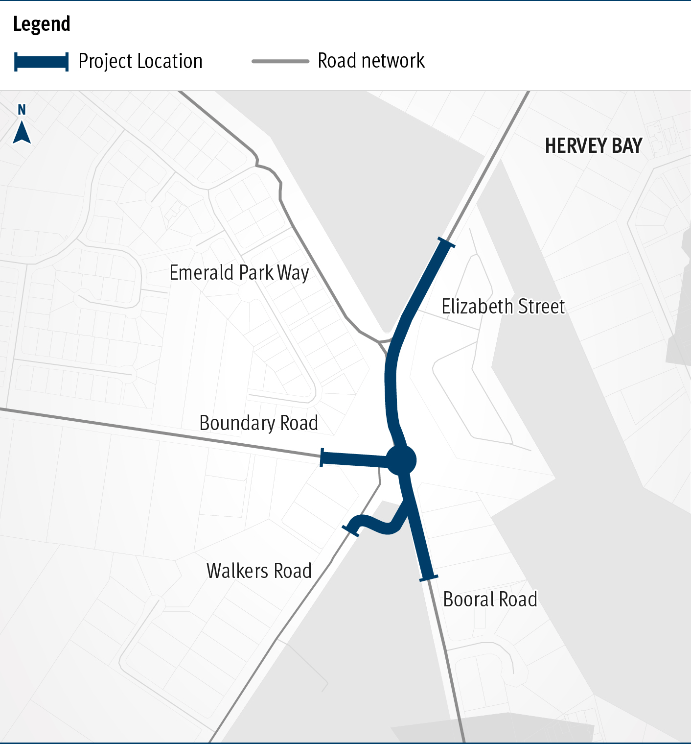
  1. Booral Road and Boundary Road (Urangan), intersection upgrade

    Detailed design is underway for a proposed upgrade of the Booral Road and Boundary Road intersection...

    The map shows the locality of the proposed Booral Road and Boundary Road intersection upgrade. Hervey Bay is located north-east of the project location. A solid blue line indicates the project extent, which encompasses the Booral Road and Boundary Road intersection, and also extends along Booral Road to the north past the Emerald Park Way intersection and to the south along Booral Road past the proposed new Walkers Road intersection. Walkers Road has been realigned to access Booral Road to the south of the Booral Road and Boundary Road intersection. The local road network, including where Booral Road turns into Elizabeth Street, is also highlighted on the map.
  2. Gore Highway (Pittsworth - Millmerran), various locations, rehabilitate pavement

    This project will rehabilitate sections of the Gore Highway between Pittsworth and Millmerran...

    No image supplied
  3. Toowoomba to Brisbane Passenger Rail Strategic Business Case

    This study will investigate passenger rail from Toowoomba to Brisbane...

    No image supplied
  4. New England Highway (Toowoomba-Warwick) Hodgson Creek to Cambooya Connection Road – options analysis

    This planning project is investiged options to improve the safety and efficiency of the New England Highway south of Toowoomba, between Hodgson Creek and Cambooya Connection Road...

    No image supplied
  5. Cunningham Highway safety upgrades – Warwick to Inglewood

    Planning is underway to make the Cunningham Highway safer between Warwick and Inglewood...

    No image supplied
  6. New England Highway (Yarraman - Toowoomba), Borneo Barracks (Cabarlah), construct turning lanes

    The department is working with the Department of Defence to upgrade the entrance to the Borneo Barracks from the New England Highway at Cabarlah...

    No image supplied
  7. Warrego Highway Upgrade Program

    The Warrego Highway Upgrade Program extends from Ipswich to Charleville and started in 2013. The program is focussed on improving freight productivity, efficiency, resilience and road safety...

    No image supplied
  8. Oakey-Pittsworth Road, various locations, business case

    Planning is underway to increase safety, efficiency and reliability of Oakey-Pittsworth Road...

    No image supplied
  9. Booral Road, Bunya Creek floodway and Main Street intersection upgrade, planning

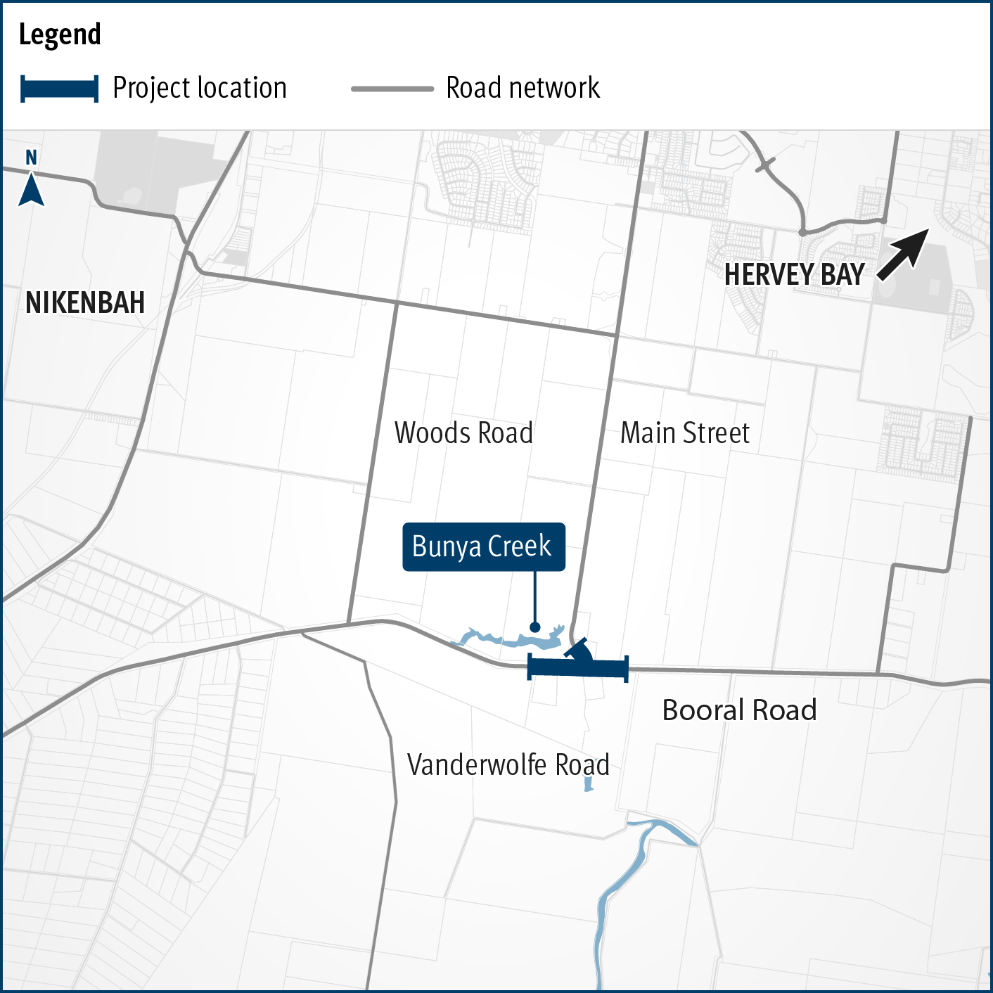
    Planning is underway to improve flood immunity and safety on a section of Booral Road at Bunya Creek, including the Main Street intersection...

    Alternative text: The map shows the locality of the proposed Booral Road, Bunya Creek floodway and Main Street intersection upgrade. Nikenbah is located to the north and Hervey Bay to the north-east. Bunya Creek is located just north west of the proposed project location. A solid dark blue line indicates the project extent, which encompasses the Booral Road and Main Street intersection as well as the Bunya Creek floodway along Booral Road, which is located just west of the intersection. The local road network, including Woods Road and Vanderwolfe Road are also highlighted on the map.
  10. Cunningham Highway Upgrade

    The department has developed a plan to upgrade the Cunningham Highway...

    No image supplied