Showing results 1-10 of 21

Sort results
Sort results
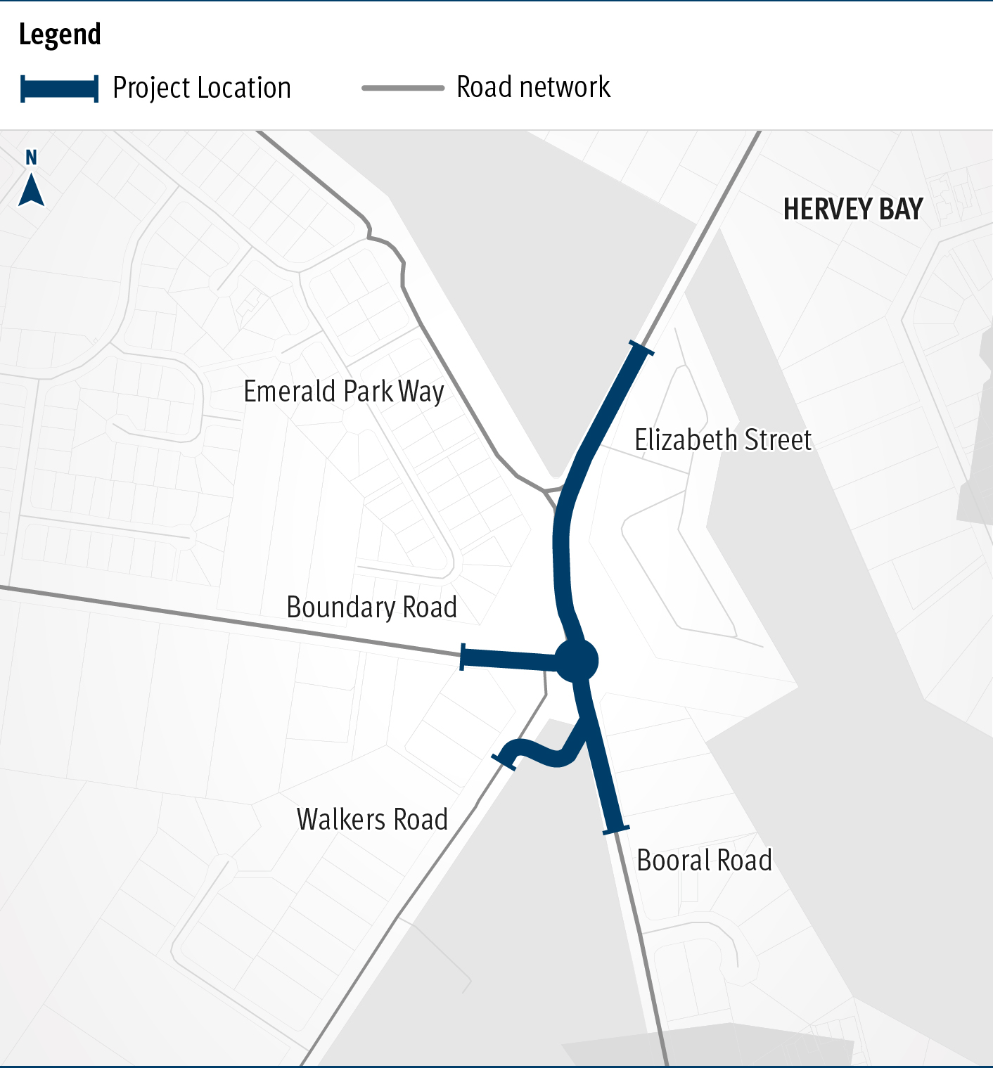
  1. Maryborough - Hervey Bay Road and Pialba - Burrum Heads Road, upgrade intersection

    The Department of Transport and Main Roads is undertaking detailed design for an upgrade of the Maryborough-Hervey Bay Road and Pialba-Burrum Heads Road intersection in Eli Waters...

    No image supplied
  2. Booral Road and Boundary Road (Urangan), intersection upgrade

    Detailed design is underway for a proposed upgrade of the Booral Road and Boundary Road intersection...

    The map shows the locality of the proposed Booral Road and Boundary Road intersection upgrade. Hervey Bay is located north-east of the project location. A solid blue line indicates the project extent, which encompasses the Booral Road and Boundary Road intersection, and also extends along Booral Road to the north past the Emerald Park Way intersection and to the south along Booral Road past the proposed new Walkers Road intersection. Walkers Road has been realigned to access Booral Road to the south of the Booral Road and Boundary Road intersection. The local road network, including where Booral Road turns into Elizabeth Street, is also highlighted on the map.
  3. Booral Road, Bunya Creek floodway and Main Street intersection upgrade, planning

    Planning is underway to improve flood immunity and safety on a section of Booral Road at Bunya Creek, including the Main Street intersection...

    Alternative text: The map shows the locality of the proposed Booral Road, Bunya Creek floodway and Main Street intersection upgrade. Nikenbah is located to the north and Hervey Bay to the north-east. Bunya Creek is located just north west of the proposed project location. A solid dark blue line indicates the project extent, which encompasses the Booral Road and Main Street intersection as well as the Bunya Creek floodway along Booral Road, which is located just west of the intersection. The local road network, including Woods Road and Vanderwolfe Road are also highlighted on the map.
  4. Monto – Mount Perry Road progressive sealing

    A combined funding amount of $16 million has been allocated under the Australian Government's Road Safety Program and the State Road Network Upgrades investment program to progressively seal sections...

    No image supplied
  5. Isis Highway (Bundaberg – Childers), various locations, improve safety

    Isis Highway high risk roads targeted road safety program safety improvements...

    No image supplied
  6. Southern Queensland 2022 flood reconstruction works

    Repairs are underway across South East Queensland after extensive and severe flooding was caused by sustained heavy rainfall in late February 2022...

    Landslip on Gold Coast - Springbrook Road
  7. Gympie – Brooloo Road, design active transport crossings

    Detailed design is underway for active transport bridge structures and pathway to provide connectivity of the Principal Cycle Network from Gympie's southside into the Gympie CBD and surrounds...

    No image supplied
  8. Maryborough-Hervey Bay Road, Ibis Boulevard and Fairway Drive, intersection upgrade, business case

    Maryborough-Hervey Bay Road/Ibis Boulevard/Fairway Drive intersection upgrade...

    No image supplied
  9. Torbanlea manufacturing facility

    We are expected to start construction of the Queensland Train Manufacturing Program manufacturing facility in 2023...

    Artist's impression of the Torbanlea train manufacturing facility
  10. Bruce Highway (Gympie – Maryborough), Tiaro Bypass, construct four lane bypass

    We are improving flood immunity, safety and efficiency on the Bruce Highway at Tiaro...

    No image supplied
Previous Page (disabled)
  1. Page 1
  2. Page 2
  3. Page 3