
Gregory Developmental Road (Charters Towers - Lynd), package of works
Culvert upgrade, pavement strengthening and pavement widening on Gregory Developmental Road between Charters Towers and the Lynd...
Culvert upgrade, pavement strengthening and pavement widening on Gregory Developmental Road between Charters Towers and the Lynd...

A new upstream bridge will be constructed over Ross River in Townsville adjacent to the existing Bowen Road Bridge...
Bruce Highway safety upgrades at Clemant...
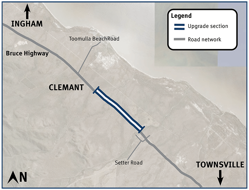
Construction started in June 2021 and was completed in early October 2023...
Construction of a new northbound overtaking lane on the Bruce Highway at Fredericksfield and upgrades to the intersection with Mount Inkerman Road...
The Department of Transport and Main Roads (TMR) is undertaking safety improvement works at various locations across three state-controlled roads in Townsville: South Townsville Road – from the...
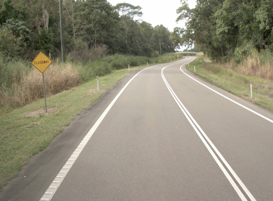
Planning has commenced to improve safety and reduce the time of closure due to flooding on a complex section of the Bruce Highway at the Gairloch floodway, 5km north of Ingham...
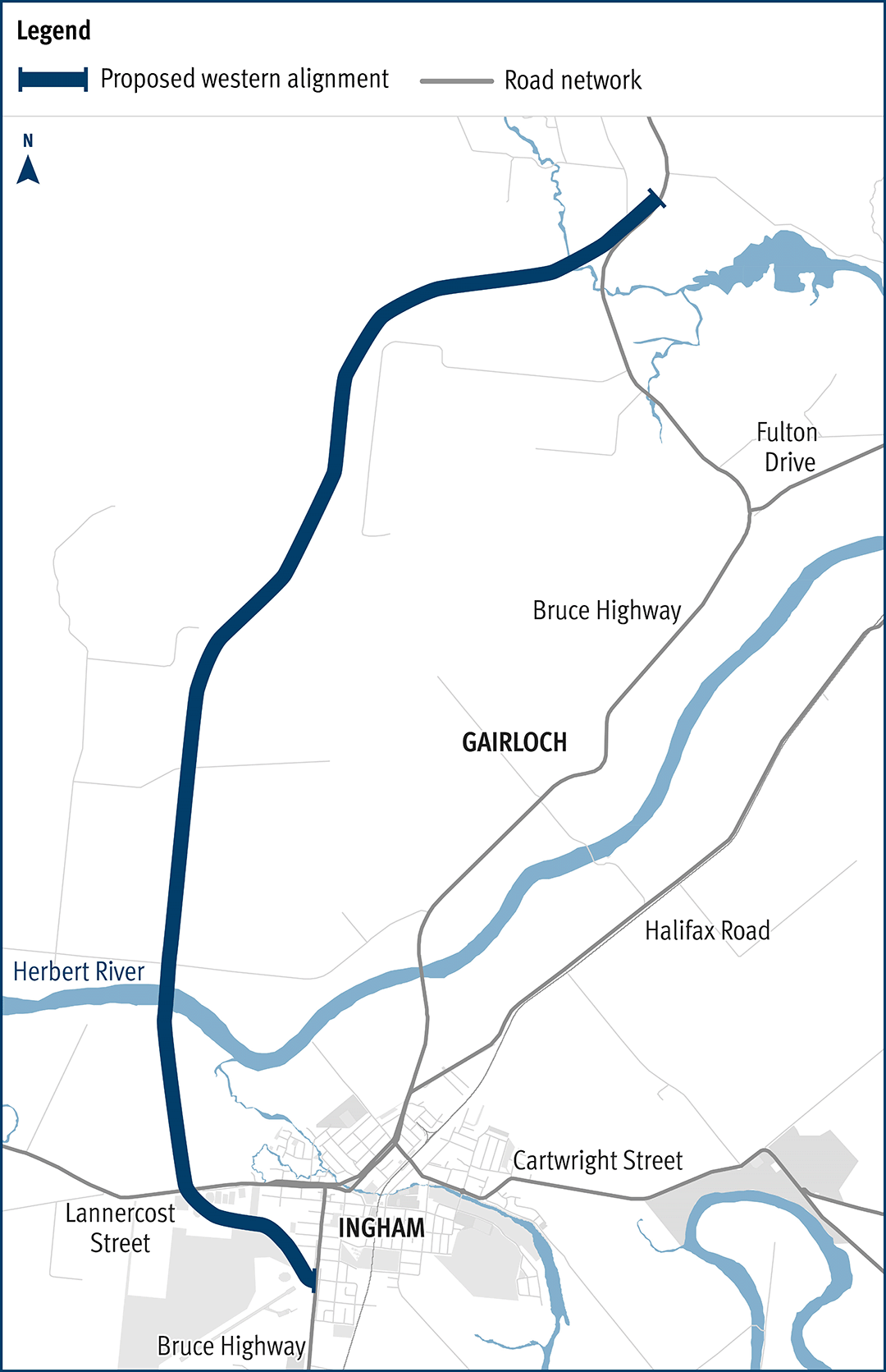
The department has been actively working with the community to address the challenges associated with the Bruce Highway from South of Ingham to the Cardwell Range...
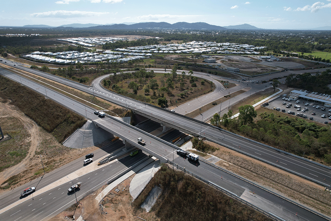
The Townsville Northern Access Intersections Upgrade project will improve road safety, efficiency and travel time reliability for freight and passenger vehicles on the Bruce Highway in Townsville...
Safety upgrades will be carried out at various locations along North Ward Road...
